
Tri-City 🇺🇸
-
Nautical Twilight begins:05:14 amSunrise:06:19 am
-
Sunset:08:04 pmNautical Twilight ends:09:10 pm
-
Moonrise:03:25 am
-
Moonset:12:46 pm
-
Moon over:08:05 am
-
Moon under:08:20 pm
-
Visibility:42%
-
 Third Quarter Moon
-
Distance to earth:380,488 kmProximity:59.2 %
Moon Phases for Tri-City
-
average Day
-
minor Time:02:25 am - 04:25 am
-
major Time:07:05 am - 09:05 am
-
minor Time:11:46 am - 01:46 pm
-
major Time:
 07:20 pm -
09:20 pm
07:20 pm -
09:20 pm
| Date | Major Bite Times | Minor Bite Times | Sun | Moon | Moonphase |
|---|---|---|---|---|---|
|
Mon, 21 Apr
|
07:05 am -
09:05 am
07:20 pm -
09:20 pm
|
02:25 am -
04:25 am
11:46 am -
01:46 pm
|
R: 06:19 am S: 08:04 pm |
R: 03:25 am S: 12:46 pm |
Third Quarter Moon |
|
Tue, 22 Apr
|
07:57 am -
09:57 am
08:09 pm -
10:09 pm
|
02:54 am -
04:54 am
01:01 pm -
03:01 pm
|
R: 06:18 am S: 08:06 pm |
R: 03:54 am S: 02:01 pm |
Third Quarter Moon |
|
Wed, 23 Apr
|
08:48 am -
10:48 am
08:59 pm -
10:59 pm
|
03:18 am -
05:18 am
02:18 pm -
04:18 pm
|
R: 06:16 am S: 08:07 pm |
R: 04:18 am S: 03:18 pm |
Waning Crescent |
|
Thu, 24 Apr
|
09:37 am -
11:37 am
09:49 pm -
11:49 pm
|
03:40 am -
05:40 am
03:34 pm -
05:34 pm
|
R: 06:15 am S: 08:08 pm |
R: 04:40 am S: 04:34 pm |
Waning Crescent |
|
Fri, 25 Apr
|
10:28 am -
12:28 pm
10:40 pm -
12:40 am
|
04:03 am -
06:03 am
04:54 pm -
06:54 pm
|
R: 06:13 am S: 08:09 pm |
R: 05:03 am S: 05:54 pm |
Waning Crescent |
|
Sat, 26 Apr
|
11:21 am -
01:21 pm
11:08 pm -
01:08 am
|
04:26 am -
06:26 am
06:16 pm -
08:16 pm
|
R: 06:12 am S: 08:10 pm |
R: 05:26 am S: 07:16 pm |
New Moon |
|
Sun, 27 Apr
|
12:00 am -
02:00 am
12:16 pm -
02:16 pm
|
04:52 am -
06:52 am
07:40 pm -
09:40 pm
|
R: 06:10 am S: 08:11 pm |
R: 05:52 am S: 08:40 pm |
New Moon |


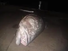
uploaded by: Stixy

uploaded by: Stixy

uploaded by: Stixy

uploaded by: Stixy

uploaded by: K Richard

uploaded by: Stixy

uploaded by: Joey Piercefield

uploaded by: Joey Piercefield

uploaded by: Joey Piercefield

uploaded by: Joey Piercefield
Best Fishing Spots in the greater Tri-City area
We found a total of 12 potential fishing spots nearby Tri-City. Below you can find them organized on a map. Points, Headlands, Reefs, Islands, Channels, etc can all be productive fishing spots. As these are user submitted spots, there might be some errors in the exact location. You also need to cross check local fishing regulations. Some of the spots might be in or around marine reserves or other locations that cannot be fished. If you click on a location marker it will bring up some details and a quick link to google search, satellite maps and fishing times. Tip: Click/Tap on a new area to load more fishing spots.
Corder Log Pond Dike - 4km , Fords Bridge - 4km , Yokum Bridge - 5km , Neal Lane Bridge - 5km , Caroline Raymond Bridge - 11km , Mary Moore Bridge (historical) - 12km , Martha Rice Bridge - 14km , Ornoname 11 Dam - 15km , Pacific Plywood Dam - 16km , Winston Bridge - 18km , Galesville Dam - 19km , Ornoname 12 Dam - 20km
Comments