

Suwanee Old Town (historical) 🇺🇸
-
Nautical Twilight begins:05:58 amSunrise:06:51 am
-
Sunset:08:08 pmNautical Twilight ends:09:01 pm
-
Moonrise:06:30 am
-
Moonset:08:19 pm
-
Moon over:01:24 pm
-
Moon under:01:03 am
-
Visibility:0%
-
 New Moon
-
Distance to earth:363,306 kmProximity:99.5 %
Moon Phases for Suwanee Old Town (historical)
-
excellent Day
-
major Time:12:03 am - 02:03 am
-
minor Time:
 05:30 am -
07:30 am
05:30 am -
07:30 am
-
major Time:12:24 pm - 02:24 pm
-
minor Time:
07:19 pm -
09:19 pm
Tide Clock
Tide Graph
Times
| Tide | Time | Height |
|---|---|---|
| high | 02:33 am | 3.44 ft |
| low | 08:14 am | 0.92 ft |
| high | 01:51 pm | 3.74 ft |
| low | 09:01 pm | -0.89 ft |
| Date | Major Bite Times | Minor Bite Times | Sun | Moon | Moonphase | Tide Times |
|---|---|---|---|---|---|---|
|
Sun, 27 Apr
|
12:03 am -
02:03 am
12:24 pm -
02:24 pm
|
05:30 am -
07:30 am
07:19 pm -
09:19 pm
|
R: 06:51 am S: 08:08 pm |
R: 06:30 am S: 08:19 pm |
New Moon |
high: 02:33 am
, 3.44 ft
, Coeff: 114
low: 08:14 am
, 0.92 ft
high: 01:51 pm
, 3.74 ft
, Coeff: 131
low: 09:01 pm
, -0.89 ft
|
|
Mon, 28 Apr
|
12:59 am -
02:59 am
01:23 pm -
03:23 pm
|
06:12 am -
08:12 am
08:34 pm -
10:34 pm
|
R: 06:50 am S: 08:08 pm |
R: 07:12 am S: 09:34 pm |
New Moon |
high: 03:23 am
, 3.38 ft
, Coeff: 111
low: 08:48 am
, 1.18 ft
high: 02:21 pm
, 3.87 ft
, Coeff: 139
low: 09:46 pm
, -1.02 ft
|
|
Tue, 29 Apr
|
01:55 am -
03:55 am
02:24 pm -
04:24 pm
|
07:00 am -
09:00 am
09:48 pm -
11:48 pm
|
R: 06:50 am S: 08:09 pm |
R: 08:00 am S: 10:48 pm |
Waxing Crescent |
high: 04:12 am
, 3.18 ft
, Coeff: 100
low: 09:20 am
, 1.41 ft
high: 02:53 pm
, 3.94 ft
, Coeff: 142
low: 10:33 pm
, -0.95 ft
|
|
Wed, 30 Apr
|
02:55 am -
04:55 am
03:26 pm -
05:26 pm
|
07:57 am -
09:57 am
10:56 pm -
12:56 am
|
R: 06:49 am S: 08:09 pm |
R: 08:57 am S: 11:56 pm |
Waxing Crescent |
high: 05:02 am
, 2.92 ft
, Coeff: 85
low: 09:51 am
, 1.57 ft
high: 03:26 pm
, 3.9 ft
, Coeff: 140
low: 11:22 pm
, -0.72 ft
|
|
Thu, 01 May
|
03:53 am -
05:53 am
04:27 pm -
06:27 pm
|
08:59 am -
10:59 am
11:56 pm -
01:56 am
|
R: 06:48 am S: 08:10 pm |
R: 09:59 am S: - |
Waxing Crescent |
high: 05:54 am
, 2.62 ft
, Coeff: 68
low: 10:24 am
, 1.67 ft
high: 04:02 pm
, 3.74 ft
, Coeff: 131
|
|
Fri, 02 May
|
05:01 am -
07:01 am
05:34 pm -
07:34 pm
|
10:06 am -
12:06 pm
11:56 pm -
01:56 am
|
R: 06:47 am S: 08:11 pm |
R: 11:06 am S: 12:56 am |
Waxing Crescent |
low: 12:16 am
, -0.36 ft
high: 06:54 am
, 2.36 ft
, Coeff: 53
low: 11:00 am
, 1.8 ft
high: 04:42 pm
, 3.44 ft
, Coeff: 114
|
|
Sat, 03 May
|
05:59 am -
07:59 am
06:31 pm -
08:31 pm
|
12:47 am -
02:47 am
11:11 am -
01:11 pm
|
R: 06:46 am S: 08:11 pm |
R: 12:11 pm S: 01:47 am |
First Quarter Moon |
low: 01:18 am
, 0.03 ft
high: 08:09 am
, 2.2 ft
, Coeff: 44
low: 11:49 am
, 1.9 ft
high: 05:29 pm
, 3.08 ft
, Coeff: 94
|
")


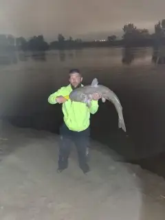
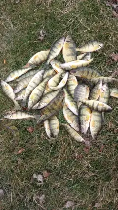
uploaded by: Mr catch it
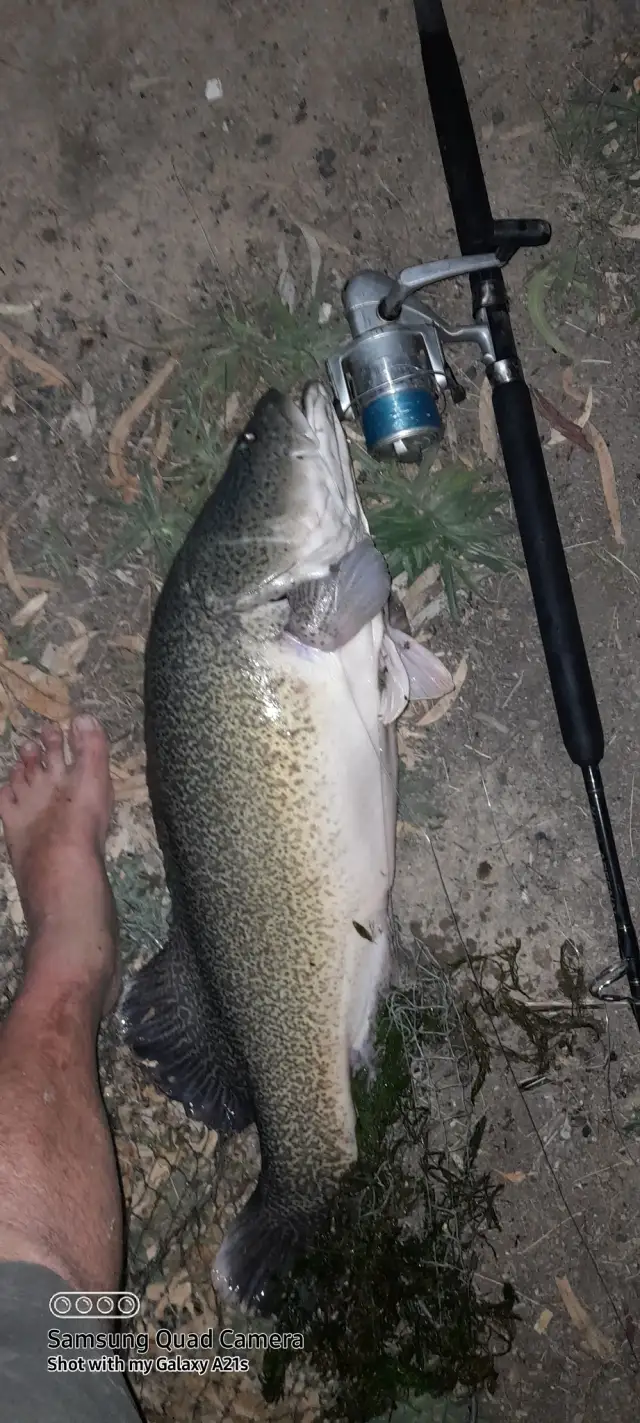
uploaded by: Graeme Lhuillier

uploaded by: Tony Barker_1

uploaded by: Zander Paul Slabber

uploaded by: Craig Aulenback

uploaded by: Craig Aulenback

uploaded by: Craig Aulenback

uploaded by: Craig Aulenback

uploaded by: Eric Dixon_1

uploaded by: Stixy
Best Fishing Spots in the greater Suwanee Old Town (historical) area
Beaches and Bays are ideal places for land-based fishing. If the beach is shallow and the water is clear then twilight times are usually the best times, especially when they coincide with a major or minor fishing time. Often the points on either side of a beach are the best spots. Or if the beach is large then look for irregularities in the breaking waves, indicating sandbanks and holes. We found 1 beaches and bays in this area.
Camp Pond - 17km
Harbours and Marinas can often times be productive fishing spots for land based fishing as their sheltered environment attracts a wide variety of bait fish. Similar to river mouths, harbour entrances are also great places to fish as lots of fish will move in and out with the rising and falling tides. There are 1 main harbours in this area.
Airport Canal - 14km
We found a total of 49 potential fishing spots nearby Suwanee Old Town (historical). Below you can find them organized on a map. Points, Headlands, Reefs, Islands, Channels, etc can all be productive fishing spots. As these are user submitted spots, there might be some errors in the exact location. You also need to cross check local fishing regulations. Some of the spots might be in or around marine reserves or other locations that cannot be fished. If you click on a location marker it will bring up some details and a quick link to google search, satellite maps and fishing times. Tip: Click/Tap on a new area to load more fishing spots.
Fanning Springs Bridge - 4km , Old Town Hammock - 5km , Jennings Lake - 5km , Long Pond - 6km , Ocean Pond - 10km , Spur Pond - 11km , Boat Lake - 11km , Bodiford Pond - 11km , Shacklefoot Pond - 12km , Sand Pond - 12km , Cow Ponds - 12km , Dixon Lake - 13km , Clearwater Pond - 14km , Joppa Lake - 14km , Airport Canal - 14km , Booth Lake - 14km , Buck Pond - 15km , Sapp Lake - 15km , Adams Lake - 15km , Alligator Lake - 15km , Goose Pond - 15km , Morgan Pond - 16km , Buttonwood Pond - 16km , Wash Pond - 16km , Fish Pond - 16km , Hammock Lake - 17km , Governor Hill Lake - 17km , Yard Pond - 17km , Bonnet Pond - 17km , Camp Pond - 17km , Careless Prairie - 17km , Mound Lake - 18km , Barpost Lake - 18km , Williams Lake - 18km , Bonnel Lake - 18km , Gator Pond - 18km , Mill Pond - 18km , Lord Lake - 18km , Drummond Pond - 18km , Fourmile Lake - 19km , Threemile Lake - 19km , Water Pond - 19km , Davis Island - 19km , Cow Pond - 19km , Black Pond - 20km , Negro Pond - 20km , Cannon Pond - 20km , Matthis Lake - 20km , Cemetery Lake - 20km
Comments