

South Scappoose 🇺🇸
-
Nautical Twilight begins:04:55 amSunrise:06:06 am
-
Sunset:08:13 pmNautical Twilight ends:09:23 pm
-
Moonrise:05:00 am
-
Moonset:05:54 pm
-
Moon over:11:27 am
-
Moon under:11:38 pm
-
Visibility:6%
-
 Waning Crescent
-
Distance to earth:365,207 kmProximity:95.1 %
Moon Phases for South Scappoose
-
average Day
-
minor Time:04:00 am - 06:00 am
-
major Time:10:27 am - 12:27 pm
-
minor Time:04:54 pm - 06:54 pm
-
major Time:10:38 pm - 12:38 am
Tide Clock
Tide Graph
Times
| Tide | Time | Height |
|---|---|---|
| high | 04:26 am | 2.53 ft |
| low | 11:59 am | 0.59 ft |
| high | 04:40 pm | 2.49 ft |
| Date | Major Bite Times | Minor Bite Times | Sun | Moon | Moonphase | Tide Times |
|---|---|---|---|---|---|---|
|
Fri, 25 Apr
|
10:27 am -
12:27 pm
10:38 pm -
12:38 am
|
04:00 am -
06:00 am
04:54 pm -
06:54 pm
|
R: 06:06 am S: 08:13 pm |
R: 05:00 am S: 05:54 pm |
Waning Crescent |
high: 04:26 am
, 2.53 ft
, Coeff: 99
low: 11:59 am
, 0.59 ft
high: 04:40 pm
, 2.49 ft
, Coeff: 97
|
|
Sat, 26 Apr
|
11:20 am -
01:20 pm
11:08 pm -
01:08 am
|
04:21 am -
06:21 am
06:19 pm -
08:19 pm
|
R: 06:04 am S: 08:14 pm |
R: 05:21 am S: 07:19 pm |
New Moon |
low: 12:15 am
, 0.2 ft
high: 05:07 am
, 2.82 ft
, Coeff: 120
low: 01:09 pm
, 0.49 ft
high: 05:32 pm
, 2.33 ft
, Coeff: 85
|
|
Sun, 27 Apr
|
12:01 am -
02:01 am
12:15 pm -
02:15 pm
|
04:44 am -
06:44 am
07:47 pm -
09:47 pm
|
R: 06:03 am S: 08:16 pm |
R: 05:44 am S: 08:47 pm |
New Moon |
low: 12:52 am
, 0.16 ft
high: 05:48 am
, 3.08 ft
, Coeff: 139
low: 02:12 pm
, 0.36 ft
high: 06:23 pm
, 2.17 ft
, Coeff: 73
|
|
Mon, 28 Apr
|
12:54 am -
02:54 am
01:13 pm -
03:13 pm
|
05:12 am -
07:12 am
09:15 pm -
11:15 pm
|
R: 06:01 am S: 08:17 pm |
R: 06:12 am S: 10:15 pm |
New Moon |
low: 01:32 am
, 0.16 ft
high: 06:31 am
, 3.25 ft
, Coeff: 150
low: 03:10 pm
, 0.3 ft
high: 07:14 pm
, 1.97 ft
, Coeff: 60
|
|
Tue, 29 Apr
|
01:49 am -
03:49 am
02:14 pm -
04:14 pm
|
05:49 am -
07:49 am
10:39 pm -
12:39 am
|
R: 05:59 am S: 08:18 pm |
R: 06:49 am S: 11:39 pm |
Waxing Crescent |
low: 02:13 am
, 0.16 ft
high: 07:15 am
, 3.31 ft
, Coeff: 155
low: 04:05 pm
, 0.26 ft
high: 08:06 pm
, 1.84 ft
, Coeff: 50
|
|
Wed, 30 Apr
|
02:42 am -
04:42 am
03:13 pm -
05:13 pm
|
06:38 am -
08:38 am
11:49 pm -
01:49 am
|
R: 05:58 am S: 08:20 pm |
R: 07:38 am S: - |
Waxing Crescent |
low: 02:57 am
, 0.2 ft
high: 08:01 am
, 3.28 ft
, Coeff: 153
low: 05:00 pm
, 0.33 ft
high: 09:02 pm
, 1.74 ft
, Coeff: 43
|
|
Thu, 01 May
|
03:44 am -
05:44 am
04:20 pm -
06:20 pm
|
07:40 am -
09:40 am
11:49 pm -
01:49 am
|
R: 05:56 am S: 08:21 pm |
R: 08:40 am S: 12:49 am |
Waxing Crescent |
low: 03:42 am
, 0.23 ft
high: 08:48 am
, 3.12 ft
, Coeff: 141
low: 05:54 pm
, 0.39 ft
high: 10:04 pm
, 1.67 ft
, Coeff: 39
|


uploaded by: Tony Barker_1

uploaded by: Zander Paul Slabber

uploaded by: Craig Aulenback

uploaded by: Craig Aulenback

uploaded by: Craig Aulenback

uploaded by: Craig Aulenback

uploaded by: Eric Dixon_1

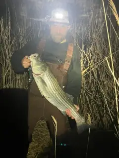
uploaded by: Stixy

uploaded by: Stixy

uploaded by: Stixy
Best Fishing Spots in the greater South Scappoose area
Wharf's or Jetties are good places to wet a line and meet other fishermen. They often produce a fresh feed of fish and are also great to catch bait fish. As they are often well lit, they also provide a good opportunity for night fishing. There are 1 wharf(s) in this area.
Casselman's Wharf - 3km
Beaches and Bays are ideal places for land-based fishing. If the beach is shallow and the water is clear then twilight times are usually the best times, especially when they coincide with a major or minor fishing time. Often the points on either side of a beach are the best spots. Or if the beach is large then look for irregularities in the breaking waves, indicating sandbanks and holes. We found 5 beaches and bays in this area.
Scappoose Bay - 10km , Campbell Lake - 10km , Port of Saint Helen's Scappoose Bay Marina - 10km , Port of Saint Helen's Scappoose Bay Marina Public Ramp - 10km , Lyons Beach - 12km
Harbours and Marinas can often times be productive fishing spots for land based fishing as their sheltered environment attracts a wide variety of bait fish. Similar to river mouths, harbour entrances are also great places to fish as lots of fish will move in and out with the rising and falling tides. There are 13 main harbours in this area.
Scappoose Rural Fire Protection District Marina - 2km, Scappoose Moorage - 2km, McCuddy's / Browns Landing Marina Boat Launch - 2km, McCuddy's / Browns Landing Marina - 2km, Rivers Bend Marina - 3km, McCuddy's Big Oak Marina - 4km, Coon Island Marina - 5km, Rock Point Marina - 5km, Rocky Point Marina - 5km, Happy Rock Moorage - 6km, Port of Saint Helen's Scappoose Bay Marina - 10km, Port of Saint Helen's Scappoose Bay Marina Public Ramp - 10km, Sauvie Island Moorage - 11km
We found a total of 97 potential fishing spots nearby South Scappoose. Below you can find them organized on a map. Points, Headlands, Reefs, Islands, Channels, etc can all be productive fishing spots. As these are user submitted spots, there might be some errors in the exact location. You also need to cross check local fishing regulations. Some of the spots might be in or around marine reserves or other locations that cannot be fished. If you click on a location marker it will bring up some details and a quick link to google search, satellite maps and fishing times. Tip: Click/Tap on a new area to load more fishing spots.
Round Lake - 2km , Scappoose Rural Fire Protection District Marina - 2km , Scappoose Moorage - 2km , McCuddy's / Browns Landing Marina Boat Launch - 2km , McCuddy's / Browns Landing Marina - 2km , Woods Pond - 3km , Casselman's Wharf - 3km , Rivers Bend Marina - 3km , Mouse Island Lake (historical) - 4km , Martin Lake - 4km , Steelman Lake - 4km , West Arm - 4km , McCuddy's Big Oak Marina - 4km , Ammunition Point - 5km , Grassy Lake - 5km , Holman Point - 5km , Jack Slough - 5km , James O Fisher Dam - 5km , Oak Island - 5km , Seal Lake - 5km , Wagonwheel Hole - 5km , Willow Hole - 5km , Coon Island Marina - 5km , Rock Point Marina - 5km , Rocky Point Marina - 5km , Coon Island - 6km , Crane Lake - 6km , Domeyer Lake - 6km , Haldeman Pond - 6km , Malarky Lake - 6km , Mud Lake - 6km , North Arm - 6km , Petes Slough - 6km , Rentenaar Point - 6km , Sturgeon Lake - 6km , The Wash - 6km , Happy Rock Moorage - 6km , Aarons Lake - 7km , Crane Slough - 7km , Gay Lake - 7km , Howard Schmidt Dam - 7km , McNary Lake - 7km , Moar Lake - 7km , Racetrack Lake - 7km , Sauvie Island - 7km , Sauvie Island Dam - 7km , Ash Slough - 8km , Broad Slough - 8km , Coon Point - 8km , Guiles Lake - 8km , Heinen Pond - 8km , Horseshoe Island - 8km , Johnson Lake - 8km , Mud Slough - 8km , Bryce Lake - 9km , Cunningham Lake - 9km , Griffith Island (historical) - 9km , Marquam Lake - 9km , McCormick Lake - 9km , Rays Lake - 9km , Reeder Point - 9km , Sand Island (historical) - 9km , Whittier Lake - 9km , Willow Bar Islands - 9km , Willow Point - 9km , Knapp Point - 9km , Henrici Lake - 10km , Marquam Dry Lake Canal - 10km , Scappoose Bay - 10km , Bachelor Point - 10km , Campbell Lake - 10km , Caterpillar Island - 10km , Post Office Lake - 10km , Port of Saint Helen's Scappoose Bay Marina - 10km , Port of Saint Helen's Scappoose Bay Marina Public Ramp - 10km , Cunningham Slough - 11km , Millionaire Lake - 11km , School Section Lake - 11km , Bower Slough - 11km , Curtis Lake - 11km , Green Lake - 11km , Hewlett Point - 11km , Sauvie Island Moorage - 11km , Cathlacom Point - 12km , Deep Lake - 12km , Howell Lake - 12km , Kay Dam - 12km , Louse Island - 12km , Lyons Beach - 12km , Widgeon Lake - 12km , Bachelor Island - 12km , Bachelor Island Slough - 12km , Canvasback Lake - 12km , Quigley Lake - 12km , Belle Vue Point - 13km , Lily Pond - 13km , Van Raden Dam - 13km
Comments