North Laurel 🇺🇸
-
Nautical Twilight begins:05:51 amSunrise:06:48 am
-
Sunset:07:34 pmNautical Twilight ends:08:31 pm
-
Moonrise:09:17 am
-
Moonset:12:03 am
-
Moon over:05:07 pm
-
Moon under:04:40 am
-
Visibility:24%
-
 Waxing Crescent
-
Distance to earth:367,759 kmProximity:89.1 %
Moon Phases for North Laurel
-
good Day
-
major Time:03:40 am - 05:40 am
-
minor Time:08:17 am - 10:17 am
-
major Time:04:07 pm - 06:07 pm
-
minor Time:11:03 pm - 01:03 am
| Date | Major Bite Times | Minor Bite Times | Sun | Moon | Moonphase | Tide Times |
|---|---|---|---|---|---|---|
|
Wed, 02 Apr
|
03:40 am -
05:40 am
04:07 pm -
06:07 pm
|
08:17 am -
10:17 am
11:03 pm -
01:03 am
|
R: 06:48 am S: 07:34 pm |
R: 09:17 am S: 12:03 am |
Waxing Crescent |
|
|
Thu, 03 Apr
|
04:44 am -
06:44 am
05:16 pm -
07:16 pm
|
12:17 am -
02:17 am
09:11 am -
11:11 am
|
R: 06:47 am S: 07:35 pm |
R: 10:11 am S: 01:17 am |
First Quarter Moon |
|
|
Fri, 04 Apr
|
05:47 am -
07:47 am
06:21 pm -
08:21 pm
|
01:20 am -
03:20 am
10:14 am -
12:14 pm
|
R: 06:45 am S: 07:36 pm |
R: 11:14 am S: 02:20 am |
First Quarter Moon |
|
|
Sat, 05 Apr
|
06:47 am -
08:47 am
07:22 pm -
09:22 pm
|
02:12 am -
04:12 am
11:22 am -
01:22 pm
|
R: 06:43 am S: 07:37 pm |
R: 12:22 pm S: 03:12 am |
First Quarter Moon |
|
|
Sun, 06 Apr
|
07:42 am -
09:42 am
08:15 pm -
10:15 pm
|
02:53 am -
04:53 am
12:31 pm -
02:31 pm
|
R: 06:42 am S: 07:38 pm |
R: 01:31 pm S: 03:53 am |
First Quarter Moon |
|
|
Mon, 07 Apr
|
08:31 am -
10:31 am
09:03 pm -
11:03 pm
|
03:25 am -
05:25 am
01:37 pm -
03:37 pm
|
R: 06:40 am S: 07:39 pm |
R: 02:37 pm S: 04:25 am |
Waxing Gibbous |
|
|
Tue, 08 Apr
|
09:16 am -
11:16 am
09:47 pm -
11:47 pm
|
03:51 am -
05:51 am
02:41 pm -
04:41 pm
|
R: 06:39 am S: 07:40 pm |
R: 03:41 pm S: 04:51 am |
Waxing Gibbous |


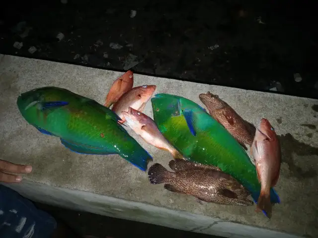
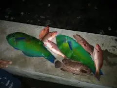
uploaded by: Wayne Robinson_1

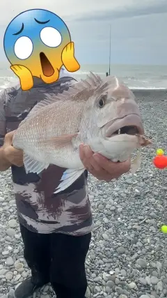
uploaded by: Floyd pink

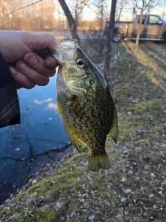
uploaded by: Joey Piercefield

uploaded by: Joey Piercefield

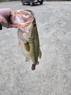
uploaded by: Charlie Pifer

uploaded by: Charlie Pifer

uploaded by: Charlie Pifer

uploaded by: Charlie Pifer

uploaded by: dazzling79

uploaded by: Kendubp
Best Fishing Spots in the greater North Laurel area
We found a total of 39 potential fishing spots nearby North Laurel. Below you can find them organized on a map. Points, Headlands, Reefs, Islands, Channels, etc can all be productive fishing spots. As these are user submitted spots, there might be some errors in the exact location. You also need to cross check local fishing regulations. Some of the spots might be in or around marine reserves or other locations that cannot be fished. If you click on a location marker it will bring up some details and a quick link to google search, satellite maps and fishing times. Tip: Click/Tap on a new area to load more fishing spots.
Savage Dam - 3km , Bollman Suspension and Trussed Bridge - 4km , Laurel Lake - 5km , Lake Elkhorn Dam - 5km , Lake Kittamaqundi Dam - 7km , Contee Main Settling Pond Dam - 8km , Brock Bridge - 8km , Browns Bridge - 8km , Snells Bridge - 9km , Blue Pond - 9km , Simonds Bridge - 10km , Old Forge Bridge - 10km , Rocky Gorge Dam - 11km , Hance Pond - 12km , Johns Hopkins University Dam - 13km , Mallard Pond - 13km , Duvall Ponds - 13km , Duvall Bridge - 13km , Soldier Lake Dam - 13km , Bluegill Pond - 13km , Brighton Dam - 13km , Burba Lake Dam - 13km , Cash Creek Dam - 13km , Soil Conservation Service Lake Dam - 14km , Farm Pond - 14km , Shaffners Ponds - 14km , Redington Lake Dam - 14km , Foreman Branch Dam - 15km , Lemons Bridge (historical) - 15km , Bloede Dam - 15km , Thomas Viaduct - 16km , Greenbelt Dam - 16km , Wheaton Regional Park Dam - 17km , pool - 19km , pond - 19km , Union Dam - 19km , High Bridge - 19km , Clear Spring Water Reservoir Dam - 19km , Daniels Dam - 20km
Comments