Mays Landing 🇺🇸
-
Nautical Twilight begins:05:45 amSunrise:06:43 am
-
Sunset:07:23 pmNautical Twilight ends:08:21 pm
-
Moonrise:07:46 am
-
Moonset:10:36 pm
-
Moon over:03:11 pm
-
Moon under:02:53 am
-
Visibility:7%
-
 Waxing Crescent
-
Distance to earth:363,639 kmProximity:98.7 %
Moon Phases for Mays Landing
-
excellent Day
-
major Time:01:53 am - 03:53 am
-
minor Time:06:46 am - 08:46 am
-
major Time:02:11 pm - 04:11 pm
-
minor Time:09:36 pm - 11:36 pm
Tide Clock
Tide Graph
Times
| Tide | Time | Height |
|---|---|---|
| low | 06:46 am | -0.75 ft |
| high | 12:26 pm | 4.69 ft |
| low | 06:52 pm | -0.62 ft |
| Date | Major Bite Times | Minor Bite Times | Sun | Moon | Moonphase | Tide Times |
|---|---|---|---|---|---|---|
|
Mon, 31 Mar
|
01:53 am -
03:53 am
02:11 pm -
04:11 pm
|
06:46 am -
08:46 am
09:36 pm -
11:36 pm
|
R: 06:43 am S: 07:23 pm |
R: 07:46 am S: 10:36 pm |
Waxing Crescent |
low: 06:46 am
, -0.75 ft
high: 12:26 pm
, 4.69 ft
, Coeff: 130
low: 06:52 pm
, -0.62 ft
|
|
Tue, 01 Apr
|
02:45 am -
04:45 am
03:08 pm -
05:08 pm
|
07:22 am -
09:22 am
10:55 pm -
12:55 am
|
R: 06:41 am S: 07:24 pm |
R: 08:22 am S: 11:55 pm |
Waxing Crescent |
high: 12:45 am
, 5.31 ft
, Coeff: 158
low: 07:36 am
, -0.62 ft
high: 01:19 pm
, 4.4 ft
, Coeff: 117
low: 07:38 pm
, -0.39 ft
|
|
Wed, 02 Apr
|
03:41 am -
05:41 am
04:08 pm -
06:08 pm
|
12:09 am -
02:09 am
08:07 am -
10:07 am
|
R: 06:39 am S: 07:25 pm |
R: 09:07 am S: - |
Waxing Crescent |
high: 01:38 am
, 5.12 ft
, Coeff: 149
low: 08:28 am
, -0.33 ft
high: 02:17 pm
, 4.13 ft
, Coeff: 105
low: 08:27 pm
, -0.03 ft
|
|
Thu, 03 Apr
|
04:35 am -
06:35 am
05:07 pm -
07:07 pm
|
12:09 am -
02:09 am
09:01 am -
11:01 am
|
R: 06:38 am S: 07:26 pm |
R: 10:01 am S: 01:09 am |
First Quarter Moon |
high: 02:35 am
, 4.82 ft
, Coeff: 136
low: 09:25 am
, 0 ft
high: 03:18 pm
, 3.87 ft
, Coeff: 94
low: 09:23 pm
, 0.33 ft
|
|
Fri, 04 Apr
|
05:38 am -
07:38 am
06:12 pm -
08:12 pm
|
01:12 am -
03:12 am
10:04 am -
12:04 pm
|
R: 06:36 am S: 07:27 pm |
R: 11:04 am S: 02:12 am |
First Quarter Moon |
high: 03:35 am
, 4.53 ft
, Coeff: 123
low: 10:31 am
, 0.33 ft
high: 04:19 pm
, 3.67 ft
, Coeff: 85
low: 10:30 pm
, 0.66 ft
|
|
Sat, 05 Apr
|
06:38 am -
08:38 am
07:13 pm -
09:13 pm
|
02:04 am -
04:04 am
11:12 am -
01:12 pm
|
R: 06:35 am S: 07:28 pm |
R: 12:12 pm S: 03:04 am |
First Quarter Moon |
high: 04:37 am
, 4.27 ft
, Coeff: 111
low: 11:43 am
, 0.49 ft
high: 05:22 pm
, 3.58 ft
, Coeff: 80
low: 11:47 pm
, 0.82 ft
|
|
Sun, 06 Apr
|
07:33 am -
09:33 am
08:06 pm -
10:06 pm
|
02:45 am -
04:45 am
12:21 pm -
02:21 pm
|
R: 06:33 am S: 07:29 pm |
R: 01:21 pm S: 03:45 am |
First Quarter Moon |
high: 05:40 am
, 4.07 ft
, Coeff: 102
low: 12:50 pm
, 0.49 ft
high: 06:26 pm
, 3.61 ft
, Coeff: 82
|


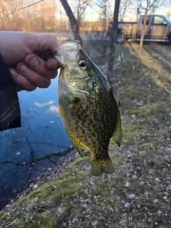
uploaded by: Joey Piercefield

uploaded by: Joey Piercefield

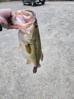
uploaded by: Charlie Pifer

uploaded by: Charlie Pifer

uploaded by: Charlie Pifer

uploaded by: Charlie Pifer

uploaded by: dazzling79

uploaded by: Kendubp

uploaded by: Kendubp

uploaded by: Kendubp
Best Fishing Spots in the greater Mays Landing area
Beaches and Bays are ideal places for land-based fishing. If the beach is shallow and the water is clear then twilight times are usually the best times, especially when they coincide with a major or minor fishing time. Often the points on either side of a beach are the best spots. Or if the beach is large then look for irregularities in the breaking waves, indicating sandbanks and holes. We found 2 beaches and bays in this area.
Scull Bay - 20km , Steelman Bay - 20km
We found a total of 28 potential fishing spots nearby Mays Landing. Below you can find them organized on a map. Points, Headlands, Reefs, Islands, Channels, etc can all be productive fishing spots. As these are user submitted spots, there might be some errors in the exact location. You also need to cross check local fishing regulations. Some of the spots might be in or around marine reserves or other locations that cannot be fished. If you click on a location marker it will bring up some details and a quick link to google search, satellite maps and fishing times. Tip: Click/Tap on a new area to load more fishing spots.
Lake Lenape Dam - 1km , Lake Lenape - 2km , Big Ditch - 7km , Stephen Lake Dam - 7km , Maple Lake Dam - 7km , Big Goose Pond - 9km , Little Goose Pond - 9km , English Creek Pond Dam - 11km , Makepeace Lake Dam - 11km , Five Acre Pond - 14km , Pancoast Mill Pond Dam - 15km , Going Through Creek - 15km , Doughty Pond Upper Dam - 16km , Egg Harbor City Lake - 16km , Bargaintown Pond - 16km , Swan Pond - 17km , Rock Point - 18km , Job Point - 18km , Lake Albert Dam - 19km , Drag Island - 19km , Tuckahoe River Island - 19km , Cushman Lake Dam - 20km , Scull Bay - 20km , Steelman Bay - 20km , Hammonton Lake Dam - 20km , Tuckahoe Dam - 20km , Bass Harbor - 20km , Kiahs Island - 20km
Comments