

Flour Bluff 🇺🇸
-
Nautical Twilight begins:06:00 amSunrise:06:52 am
-
Sunset:08:02 pmNautical Twilight ends:08:54 pm
-
Moonrise:05:54 am
-
Moonset:07:04 pm
-
Moon over:12:29 pm
-
Moon under:12:10 am
-
Visibility:2%
-
 New Moon
-
Distance to earth:363,741 kmProximity:98.5 %
Moon Phases for Flour Bluff
-
excellent Day
-
minor Time:04:54 am - 06:54 am
-
major Time:11:29 am - 01:29 pm
-
minor Time:
 06:04 pm -
08:04 pm
06:04 pm -
08:04 pm
-
major Time:11:10 pm - 01:10 am
Tide Clock
Tide Graph
Times
| Tide | Time | Height |
|---|---|---|
| low | 12:30 am | 0.43 ft |
| high | 11:06 am | 0.89 ft |
| low | 02:04 pm | 0.89 ft |
| high | 02:49 pm | 0.89 ft |
| Date | Major Bite Times | Minor Bite Times | Sun | Moon | Moonphase | Tide Times |
|---|---|---|---|---|---|---|
|
Sat, 26 Apr
|
11:29 am -
01:29 pm
11:10 pm -
01:10 am
|
04:54 am -
06:54 am
06:04 pm -
08:04 pm
|
R: 06:52 am S: 08:02 pm |
R: 05:54 am S: 07:04 pm |
New Moon |
low: 12:30 am
, 0.43 ft
high: 11:06 am
, 0.89 ft
, Coeff: 165
low: 02:04 pm
, 0.89 ft
high: 02:49 pm
, 0.89 ft
, Coeff: 165
|
|
Sun, 27 Apr
|
12:01 am -
02:01 am
12:23 pm -
02:23 pm
|
05:32 am -
07:32 am
07:15 pm -
09:15 pm
|
R: 06:51 am S: 08:02 pm |
R: 06:32 am S: 08:15 pm |
New Moon |
low: 01:02 am
, 0.26 ft
high: 12:40 pm
, 1.02 ft
, Coeff: 202
|
|
Mon, 28 Apr
|
12:57 am -
02:57 am
01:22 pm -
03:22 pm
|
06:15 am -
08:15 am
08:29 pm -
10:29 pm
|
R: 06:50 am S: 08:03 pm |
R: 07:15 am S: 09:29 pm |
New Moon |
low: 01:39 am
, 0.13 ft
high: 01:30 pm
, 1.12 ft
, Coeff: 229
|
|
Tue, 29 Apr
|
01:54 am -
03:54 am
02:23 pm -
04:23 pm
|
07:05 am -
09:05 am
09:42 pm -
11:42 pm
|
R: 06:50 am S: 08:03 pm |
R: 08:05 am S: 10:42 pm |
Waxing Crescent |
low: 02:22 am
, 0.07 ft
high: 02:22 pm
, 1.15 ft
, Coeff: 238
|
|
Wed, 30 Apr
|
02:54 am -
04:54 am
03:26 pm -
05:26 pm
|
08:02 am -
10:02 am
10:50 pm -
12:50 am
|
R: 06:49 am S: 08:04 pm |
R: 09:02 am S: 11:50 pm |
Waxing Crescent |
low: 03:15 am
, 0.07 ft
high: 03:20 pm
, 1.15 ft
, Coeff: 238
|
|
Thu, 01 May
|
03:54 am -
05:54 am
04:27 pm -
06:27 pm
|
09:05 am -
11:05 am
11:50 pm -
01:50 am
|
R: 06:48 am S: 08:04 pm |
R: 10:05 am S: - |
Waxing Crescent |
low: 04:19 am
, 0.07 ft
high: 04:25 pm
, 1.12 ft
, Coeff: 229
|
|
Fri, 02 May
|
05:00 am -
07:00 am
05:33 pm -
07:33 pm
|
10:11 am -
12:11 pm
11:50 pm -
01:50 am
|
R: 06:47 am S: 08:05 pm |
R: 11:11 am S: 12:50 am |
Waxing Crescent |
low: 05:33 am
, 0.1 ft
high: 05:30 pm
, 1.08 ft
, Coeff: 220
|


uploaded by: Tony Barker_1

uploaded by: Zander Paul Slabber

uploaded by: Craig Aulenback

uploaded by: Craig Aulenback

uploaded by: Craig Aulenback

uploaded by: Craig Aulenback

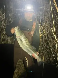
uploaded by: Eric Dixon_1

uploaded by: Stixy

uploaded by: Stixy

uploaded by: Stixy
Best Fishing Spots in the greater Flour Bluff area
Beaches and Bays are ideal places for land-based fishing. If the beach is shallow and the water is clear then twilight times are usually the best times, especially when they coincide with a major or minor fishing time. Often the points on either side of a beach are the best spots. Or if the beach is large then look for irregularities in the breaking waves, indicating sandbanks and holes. We found 3 beaches and bays in this area.
Oso Bay - 3km , Corpus Christi Bay - 11km , Corpus Christi Beach - 20km
Harbours and Marinas can often times be productive fishing spots for land based fishing as their sheltered environment attracts a wide variety of bait fish. Similar to river mouths, harbour entrances are also great places to fish as lots of fish will move in and out with the rising and falling tides. There are 11 main harbours in this area.
Laguna Marina - 5km, Land and Sea Marina - 6km, Marker 37 Marina - 6km, The Coastway Marina - 6km, Puenta Vista Marina - 7km, Bluff Landing Marina - 7km, Corpus Christi Yacht Club Marina - 17km, Corpus Christi Municipal+A2 Marina - 17km, Omni Corpus Christi Marina - 18km, Bahia Marina - 18km, Main Turning Basin - 20km
We found a total of 41 potential fishing spots nearby Flour Bluff. Below you can find them organized on a map. Points, Headlands, Reefs, Islands, Channels, etc can all be productive fishing spots. As these are user submitted spots, there might be some errors in the exact location. You also need to cross check local fishing regulations. Some of the spots might be in or around marine reserves or other locations that cannot be fished. If you click on a location marker it will bring up some details and a quick link to google search, satellite maps and fishing times. Tip: Click/Tap on a new area to load more fishing spots.
Encinal Peninsula - 1km , Oso Bay - 3km , Demit Island - 4km , Laguna Marina - 5km , Ward Island - 6km , Land and Sea Marina - 6km , Marker 37 Marina - 6km , The Coastway Marina - 6km , Crane Islands - 7km , Puenta Vista Marina - 7km , Mud Bridge - 7km , Bluff Landing Marina - 7km , Pita Island - 8km , Oso Municipal Golf Course Lake Dam - 8km , Barney M Davis Cooling Reservoir Dam - 9km , Corpus Christi Bay - 11km , Croaker Hole - 13km , Little Shamrock Cove - 14km , Shamrock Point - 14km , Shamrock Island - 15km , Shamrock Cove - 15km , Emerald Cove - 16km , Mustang Island - 16km , Pink Shack Cove - 16km , North Bird Island - 17km , Corpus Christi Yacht Club Marina - 17km , Corpus Christi Municipal+A2 Marina - 17km , Spoil Island - 18km , Omni Corpus Christi Marina - 18km , Cooks Island - 18km , Ingleside Point - 18km , Bahia Marina - 18km , Ingleside Cove - 19km , Corpus Christi Beach - 20km , Jewell Fulton Canal - 20km , Pelican Island - 20km , South Bird Island - 20km , Redfish Cove - 20km , Welder Point - 20km , Main Turning Basin - 20km , Laguna Larga - 20km
Comments