


East Tawakoni 🇺🇸
-
Nautical Twilight begins:05:40 amSunrise:06:36 am
-
Sunset:08:06 pmNautical Twilight ends:09:02 pm
-
Moonrise:07:45 am
-
Moonset:10:52 pm
-
Moon over:03:18 pm
-
Moon under:02:50 am
-
Visibility:5%
-
 Waxing Crescent
-
Distance to earth:366,151 kmProximity:92.8 %
Moon Phases for East Tawakoni
-
excellent Day
-
major Time:01:50 am - 03:50 am
-
minor Time:06:45 am - 08:45 am
-
major Time:02:18 pm - 04:18 pm
-
minor Time:09:52 pm - 11:52 pm
| Date | Major Bite Times | Minor Bite Times | Sun | Moon | Moonphase |
|---|---|---|---|---|---|
|
Tue, 29 Apr
|
01:50 am -
03:50 am
02:18 pm -
04:18 pm
|
06:45 am -
08:45 am
09:52 pm -
11:52 pm
|
R: 06:36 am S: 08:06 pm |
R: 07:45 am S: 10:52 pm |
Waxing Crescent |
|
Wed, 30 Apr
|
02:48 am -
04:48 am
03:20 pm -
05:20 pm
|
07:40 am -
09:40 am
11:01 pm -
01:01 am
|
R: 06:35 am S: 08:06 pm |
R: 08:40 am S: - |
Waxing Crescent |
|
Thu, 01 May
|
03:52 am -
05:52 am
04:26 pm -
06:26 pm
|
08:43 am -
10:43 am
11:01 pm -
01:01 am
|
R: 06:34 am S: 08:07 pm |
R: 09:43 am S: 12:01 am |
Waxing Crescent |
|
Fri, 02 May
|
04:55 am -
06:55 am
05:29 pm -
07:29 pm
|
12:00 am -
02:00 am
09:50 am -
11:50 am
|
R: 06:33 am S: 08:08 pm |
R: 10:50 am S: 01:00 am |
Waxing Crescent |
|
Sat, 03 May
|
05:53 am -
07:53 am
06:26 pm -
08:26 pm
|
12:49 am -
02:49 am
10:57 am -
12:57 pm
|
R: 06:33 am S: 08:09 pm |
R: 11:57 am S: 01:49 am |
First Quarter Moon |
|
Sun, 04 May
|
06:45 am -
08:45 am
07:16 pm -
09:16 pm
|
01:28 am -
03:28 am
12:02 pm -
02:02 pm
|
R: 06:32 am S: 08:09 pm |
R: 01:02 pm S: 02:28 am |
First Quarter Moon |
|
Mon, 05 May
|
07:32 am -
09:32 am
08:01 pm -
10:01 pm
|
02:01 am -
04:01 am
01:03 pm -
03:03 pm
|
R: 06:31 am S: 08:10 pm |
R: 02:03 pm S: 03:01 am |
First Quarter Moon |
")


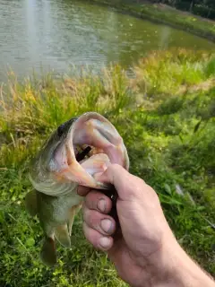
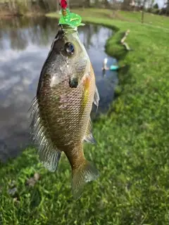
uploaded by: Mike Baron

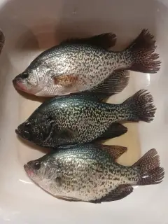
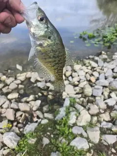
uploaded by: Mike Baron

uploaded by: Mike Baron

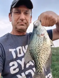
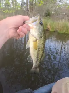
uploaded by: Bradley Wisdom

uploaded by: Bradley Wisdom

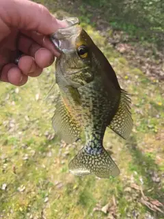
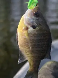
uploaded by: Joey Piercefield

uploaded by: Joey Piercefield

uploaded by: Joey Piercefield

uploaded by: Joey Piercefield

uploaded by: Joey Piercefield
Best Fishing Spots in the greater East Tawakoni area
Beaches and Bays are ideal places for land-based fishing. If the beach is shallow and the water is clear then twilight times are usually the best times, especially when they coincide with a major or minor fishing time. Often the points on either side of a beach are the best spots. Or if the beach is large then look for irregularities in the breaking waves, indicating sandbanks and holes. We found 3 beaches and bays in this area.
Wichita Bay - 8km , Screech Owl Reach - 9km , Waco Bay - 12km
We found a total of 98 potential fishing spots nearby East Tawakoni. Below you can find them organized on a map. Points, Headlands, Reefs, Islands, Channels, etc can all be productive fishing spots. As these are user submitted spots, there might be some errors in the exact location. You also need to cross check local fishing regulations. Some of the spots might be in or around marine reserves or other locations that cannot be fished. If you click on a location marker it will bring up some details and a quick link to google search, satellite maps and fishing times. Tip: Click/Tap on a new area to load more fishing spots.
Cedar Cove - 2km , Moon Point - 2km , Oak Cove - 2km , Oak Cove Bridge - 2km , Sky Point - 2km , Sun Point - 2km , Cedar Cove Bridge - 3km , Cloud Point - 3km , Squirrel Cove - 3km , Star Point - 4km , Tawakoni Causeway - 6km , Arm Point - 7km , Autumn Point - 7km , Iron Bridge Dam - 7km , Finger Point - 7km , Gum Cove - 7km , Rabbit Cove - 7km , Rainbow Point - 7km , Spring Point - 7km , Sycamore Cove - 7km , Thunder Point - 7km , Wrist Point - 7km , Mustang Cove - 8km , Wichita Bay - 8km , Wolf Cove - 8km , Red Bird Cove - 9km , Screech Owl Reach - 9km , Smoke Point - 9km , Dam Nine - 10km , Fire Point - 10km , Goose Lake - 10km , Ice Point - 10km , Montgomery Lake Dam - 10km , Soil Conservation Service Site 9 Dam - 10km , Wind Point - 10km , Ash Cove - 11km , Black Point - 11km , Hickory Cove - 11km , Snow Point - 11km , Strong Point - 11km , Walnut Cove - 11km , Dam Number 6 - 12km , Hail Point - 12km , Rain Point - 12km , Soil Conservation Service Site 6 Dam - 12km , Stone Point - 12km , Waco Bay - 12km , White Point - 12km , Arrow Point - 13km , Dam Number 4 - 13km , Duck Cove - 13km , Duck Cove Bridge - 13km , Hawk Cove - 13km , Soil Conservation Service Site 4 Dam - 13km , Soil Conservation Service Site 7 Dam - 13km , T Dam 7 - 13km , White Point Causeway - 13km , Dam Number 5 - 14km , Fish Lake - 14km , Highland Lake - 14km , Holcomb Lake - 14km , Holcomb Slough - 14km , Mulberry Cove - 14km , Soil Conservation Service Site 5 Dam - 14km , Wood Point - 14km , Burns Lake - 15km , Dam Number 2 - 15km , Dam Number 3 - 15km , Elm Cove - 15km , Soil Conservation Service Site 2 Dam - 15km , Soil Conservation Service Site 3 Dam - 15km , Kitsee Inlet - 16km , Soil Conservation Service Site 15a Dam - 16km , Goettsche Lake Dam - 17km , Soil Conservation Service Site 1 Dam - 17km , Yellow Steer Slough - 17km , Flag Pond - 18km , Greenville Club Lake Dam - 18km , Soil Conservation Service Site 12 Dam - 18km , Willow Lake Dam - 18km , Greenes Lake Dam - 19km , Lake Church - 19km , Dam Number 12 - 19km , Dam Number 14 - 19km , Dam Twentytwo - 19km , Soil Conservation Service Site 14 Dam - 19km , Soil Conservation Service Site 22 Dam - 19km , Wills Point Reservoir Dam - 19km , Dam Number 13 - 20km , Dam Number 28 - 20km , Ditch Lake - 20km , Edgewood City Lake Dam - 20km , Fin and Feather Club Lake Dam - 20km , Ocean Lake - 20km , Posey Lake - 20km , Soil Conservation Service Site 13 Dam - 20km , Soil Conservation Service Site 23 Dam - 20km , Texas No Name Number 37 Dam - 20km
Comments