

East Kansas 🇺🇸
-
Nautical Twilight begins:04:46 amSunrise:05:52 am
-
Sunset:07:48 pmNautical Twilight ends:08:55 pm
-
Moonrise:04:38 am
-
Moonset:05:22 pm
-
Moon over:11:00 am
-
Moon under:11:12 pm
-
Visibility:7%
-
 Waning Crescent
-
Distance to earth:365,482 kmProximity:94.4 %
Moon Phases for East Kansas
-
average Day
-
minor Time:03:38 am - 05:38 am
-
major Time:10:00 am - 12:00 pm
-
minor Time:04:22 pm - 06:22 pm
-
major Time:10:12 pm - 12:12 am
| Date | Major Bite Times | Minor Bite Times | Sun | Moon | Moonphase |
|---|---|---|---|---|---|
|
Fri, 25 Apr
|
10:00 am -
12:00 pm
10:12 pm -
12:12 am
|
03:38 am -
05:38 am
04:22 pm -
06:22 pm
|
R: 05:52 am S: 07:48 pm |
R: 04:38 am S: 05:22 pm |
Waning Crescent |
|
Sat, 26 Apr
|
10:52 am -
12:52 pm
11:05 pm -
01:05 am
|
04:01 am -
06:01 am
05:43 pm -
07:43 pm
|
R: 05:51 am S: 07:49 pm |
R: 05:01 am S: 06:43 pm |
New Moon |
|
Sun, 27 Apr
|
11:47 am -
01:47 pm
11:32 pm -
01:32 am
|
04:27 am -
06:27 am
07:08 pm -
09:08 pm
|
R: 05:49 am S: 07:51 pm |
R: 05:27 am S: 08:08 pm |
New Moon |
|
Mon, 28 Apr
|
12:25 am -
02:25 am
12:45 pm -
02:45 pm
|
04:57 am -
06:57 am
08:34 pm -
10:34 pm
|
R: 05:48 am S: 07:52 pm |
R: 05:57 am S: 09:34 pm |
New Moon |
|
Tue, 29 Apr
|
01:20 am -
03:20 am
01:45 pm -
03:45 pm
|
05:36 am -
07:36 am
09:55 pm -
11:55 pm
|
R: 05:47 am S: 07:53 pm |
R: 06:36 am S: 10:55 pm |
Waxing Crescent |
|
Wed, 30 Apr
|
02:15 am -
04:15 am
02:46 pm -
04:46 pm
|
06:25 am -
08:25 am
11:07 pm -
01:07 am
|
R: 05:45 am S: 07:54 pm |
R: 07:25 am S: - |
Waxing Crescent |
|
Thu, 01 May
|
03:16 am -
05:16 am
03:51 pm -
05:51 pm
|
07:26 am -
09:26 am
11:07 pm -
01:07 am
|
R: 05:44 am S: 07:55 pm |
R: 08:26 am S: 12:07 am |
Waxing Crescent |


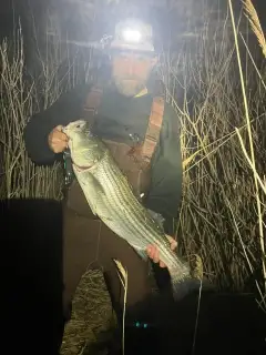
uploaded by: Tony Barker_1

uploaded by: Zander Paul Slabber

uploaded by: Craig Aulenback

uploaded by: Craig Aulenback

uploaded by: Craig Aulenback

uploaded by: Craig Aulenback

uploaded by: Eric Dixon_1

uploaded by: Stixy

uploaded by: Stixy

uploaded by: Stixy
Best Fishing Spots in the greater East Kansas area
We found a total of 40 potential fishing spots nearby East Kansas. Below you can find them organized on a map. Points, Headlands, Reefs, Islands, Channels, etc can all be productive fishing spots. As these are user submitted spots, there might be some errors in the exact location. You also need to cross check local fishing regulations. Some of the spots might be in or around marine reserves or other locations that cannot be fished. If you click on a location marker it will bring up some details and a quick link to google search, satellite maps and fishing times. Tip: Click/Tap on a new area to load more fishing spots.
Chiselville Covered Bridge - 2km , Millers Pond Dam - 4km , Lake Shaftsbury Dam - 6km , Beebe Pond - 7km , Lost Pond - 8km , Lye Brook Meadows - 8km , Branch Pond - 8km , Arlington Green Covered Bridge - 10km , Barbos Lake Dam - 10km , Bourn Pond - 11km , Equinox Pond - 11km , Hopper Pond - 11km , Hopper Brook Dam - 11km , Ricker Dam - 12km , Cider Mill Dam - 12km , Hooper Brook Dam - 12km , Lake Madeleine Dam - 12km , Shep Meadow - 13km , Stratton Pond - 13km , Little Mud Pond - 14km , Grout Pond - 14km , Streeter Island - 15km , Little Pond - 15km , Eagleville Covered Bridge - 16km , Dufresne Pond Dam - 16km , Lake Paran - 17km , Somerset Dam - 17km , Lake Paran Dam - 17km , Mill Pond - 17km , Gulf Brook Reservoir Dam - 17km , Pickerel Pond - 18km , Bullhead Pond - 19km , Paper Mill Village Bridge - 19km , Silk Road Covered Bridge - 19km , Big Pond - 19km , Red Mill Pond - 20km , Bugbee Pond Dam - 20km , Billings Pond - 20km , Adams Reservoir Dam - 20km , Henry Covered Bridge - 20km
Comments