
Clearwater Beach 🇺🇸
-
Nautical Twilight begins:06:04 amSunrise:06:56 am
-
Sunset:08:03 pmNautical Twilight ends:08:55 pm
-
Moonrise:04:46 am
-
Moonset:04:49 pm
-
Moon over:10:47 am
-
Moon under:11:04 pm
-
Visibility:14%
-
 Waning Crescent
-
Distance to earth:368,275 kmProximity:87.9 %
Moon Phases for Clearwater Beach
-
good Day
-
minor Time:03:46 am - 05:46 am
-
major Time:09:47 am - 11:47 am
-
minor Time:03:49 pm - 05:49 pm
-
major Time:10:04 pm - 12:04 am
Tide Clock
Tide Graph
Times
| Tide | Time | Height |
|---|---|---|
| low | 04:21 am | 0.23 ft |
| high | 10:31 am | 2.36 ft |
| low | 04:46 pm | 0.36 ft |
| high | 10:44 pm | 2.53 ft |
| Date | Major Bite Times | Minor Bite Times | Sun | Moon | Moonphase | Tide Times |
|---|---|---|---|---|---|---|
|
Thu, 24 Apr
|
09:47 am -
11:47 am
10:04 pm -
12:04 am
|
03:46 am -
05:46 am
03:49 pm -
05:49 pm
|
R: 06:56 am S: 08:03 pm |
R: 04:46 am S: 04:49 pm |
Waning Crescent |
low: 04:21 am
, 0.23 ft
high: 10:31 am
, 2.36 ft
, Coeff: 91
low: 04:46 pm
, 0.36 ft
high: 10:44 pm
, 2.53 ft
, Coeff: 103
|
|
Fri, 25 Apr
|
10:37 am -
12:37 pm
10:54 pm -
12:54 am
|
04:20 am -
06:20 am
04:55 pm -
06:55 pm
|
R: 06:55 am S: 08:04 pm |
R: 05:20 am S: 05:55 pm |
Waning Crescent |
low: 05:07 am
, 0.33 ft
high: 11:01 am
, 2.56 ft
, Coeff: 106
low: 05:35 pm
, -0.1 ft
high: 11:42 pm
, 2.59 ft
, Coeff: 108
|
|
Sat, 26 Apr
|
11:29 am -
01:29 pm
11:10 pm -
01:10 am
|
04:54 am -
06:54 am
06:04 pm -
08:04 pm
|
R: 06:54 am S: 08:04 pm |
R: 05:54 am S: 07:04 pm |
New Moon |
low: 05:48 am
, 0.49 ft
high: 11:31 am
, 2.76 ft
, Coeff: 120
low: 06:21 pm
, -0.49 ft
|
|
Sun, 27 Apr
|
12:01 am -
02:01 am
12:23 pm -
02:23 pm
|
05:32 am -
07:32 am
07:15 pm -
09:15 pm
|
R: 06:53 am S: 08:05 pm |
R: 06:32 am S: 08:15 pm |
New Moon |
high: 12:36 am
, 2.62 ft
, Coeff: 110
low: 06:26 am
, 0.72 ft
high: 12:02 pm
, 2.92 ft
, Coeff: 132
low: 07:06 pm
, -0.75 ft
|
|
Mon, 28 Apr
|
12:57 am -
02:57 am
01:22 pm -
03:22 pm
|
06:15 am -
08:15 am
08:29 pm -
10:29 pm
|
R: 06:52 am S: 08:05 pm |
R: 07:15 am S: 09:29 pm |
New Moon |
high: 01:28 am
, 2.53 ft
, Coeff: 103
low: 07:04 am
, 0.92 ft
high: 12:35 pm
, 3.02 ft
, Coeff: 139
low: 07:52 pm
, -0.82 ft
|
|
Tue, 29 Apr
|
01:54 am -
03:54 am
02:23 pm -
04:23 pm
|
07:04 am -
09:04 am
09:42 pm -
11:42 pm
|
R: 06:51 am S: 08:06 pm |
R: 08:04 am S: 10:42 pm |
Waxing Crescent |
high: 02:19 am
, 2.36 ft
, Coeff: 91
low: 07:40 am
, 1.12 ft
high: 01:11 pm
, 3.08 ft
, Coeff: 144
low: 08:39 pm
, -0.79 ft
|
|
Wed, 30 Apr
|
02:54 am -
04:54 am
03:26 pm -
05:26 pm
|
08:01 am -
10:01 am
10:51 pm -
12:51 am
|
R: 06:51 am S: 08:06 pm |
R: 09:01 am S: 11:51 pm |
Waxing Crescent |
high: 03:11 am
, 2.17 ft
, Coeff: 77
low: 08:16 am
, 1.28 ft
high: 01:50 pm
, 3.05 ft
, Coeff: 141
low: 09:29 pm
, -0.59 ft
|


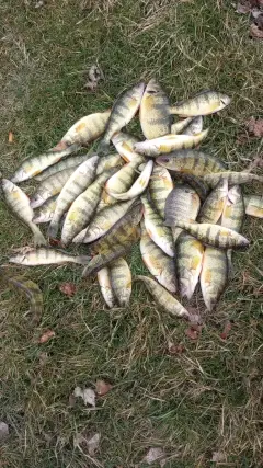
uploaded by: Craig Aulenback

uploaded by: Craig Aulenback

uploaded by: Craig Aulenback

uploaded by: Craig Aulenback

uploaded by: Eric Dixon_1

uploaded by: Stixy

uploaded by: Stixy

uploaded by: Stixy

uploaded by: Stixy

uploaded by: K Richard
Best Fishing Spots in the greater Clearwater Beach area
Beaches and Bays are ideal places for land-based fishing. If the beach is shallow and the water is clear then twilight times are usually the best times, especially when they coincide with a major or minor fishing time. Often the points on either side of a beach are the best spots. Or if the beach is large then look for irregularities in the breaking waves, indicating sandbanks and holes. We found 15 beaches and bays in this area.
Clearwater Bay - 1km , Clearwater Beach Island - 1km , Scharrer Bayou - 4km , Dunedin Beach - 9km , Little Bayou - 10km , Smith Bayou - 10km , Sutherland Bayou - 12km , Avery Bayou - 13km , Cooper Bayou - 13km , Greens Bayou - 14km , Boggy Bayou - 15km , Cross Bayou Canal - 16km , Dolly Bay - 17km , Klosterman Bayou - 17km , Little Dolly Bay - 17km
Harbours and Marinas can often times be productive fishing spots for land based fishing as their sheltered environment attracts a wide variety of bait fish. Similar to river mouths, harbour entrances are also great places to fish as lots of fish will move in and out with the rising and falling tides. There are 1 main harbours in this area.
Dunedin Marina - 5km
We found a total of 97 potential fishing spots nearby Clearwater Beach. Below you can find them organized on a map. Points, Headlands, Reefs, Islands, Channels, etc can all be productive fishing spots. As these are user submitted spots, there might be some errors in the exact location. You also need to cross check local fishing regulations. Some of the spots might be in or around marine reserves or other locations that cannot be fished. If you click on a location marker it will bring up some details and a quick link to google search, satellite maps and fishing times. Tip: Click/Tap on a new area to load more fishing spots.
Clearwater Bay - 1km , Clearwater Beach Island - 1km , Clearwater Point - 1km , Pasadees Key - 1km , Big Mangrove Key - 2km , Clearwater Harbor - 2km , Cow Island (historical) - 2km , Grassy Island (historical) - 2km , Lone Palm Island (historical) - 2km , Pope Island (historical) - 2km , Malone Point - 3km , Moonshine Island - 3km , Belleview Island - 4km , Core Island - 4km , Malone Island - 4km , Redfish Point - 4km , Scharrer Bayou - 4km , Lake Bellevue - 5km , Bird Key - 5km , Dunedin Marina - 5km , Howard Point - 5km , Point Pleasant - 5km , Caladesi Island - 6km , Crest Lake - 6km , Excelsior - 6km , Hobart Lake - 6km , Prickly Pear Point - 6km , Seven Mouth Creek - 6km , Lake Lucille - 6km , Sand Key - 7km , Sand Keys - 7km , Shell Point - 7km , Lake Sperry - 7km , Sunny Lake - 7km , Beckett Lake - 8km , Broken Island - 8km , Lake Citrus - 8km , Harbor Lake - 8km , Jerry Lake - 8km , Keene Lake - 8km , Lone Oak Point - 8km , Bascule Bridge - 9km , Church Creek Point - 9km , Dunedin Beach - 9km , McKay Point - 9km , Ward Island - 9km , Little Bayou - 10km , Honeymoon Island - 10km , Smith Bayou - 10km , Smith Islands - 10km , Brooker Creek - 11km , Burghstream Point - 11km , Lake Chautauqua - 11km , Grassy Key - 11km , Largo Inlet - 11km , Lungrun Cove - 11km , Lake Patricia - 11km , Pelican Cove - 11km , Pelican Point - 11km , North Point Hog Island - 12km , Saint Joseph Sound - 12km , Seaside Point - 12km , Sutherland Bayou - 12km , Alligator Lake - 13km , Avery Bayou - 13km , Cooper Bayou - 13km , Cooper Point - 14km , Greens Bayou - 14km , Lake Tarpon Canal - 14km , Saint George Lake - 14km , Lake Seminole - 14km , Boggy Bayou - 15km , Garden Island - 15km , Indian Bluff Island - 15km , Philippe Point - 15km , Lake Carol - 16km , Conch Key - 16km , Cross Bayou Canal - 16km , Danenman Point - 16km , Moccasin - 16km , Punkin Key - 16km , Safety Harbor - 16km , South Cove - 16km , Blossom Lake - 17km , Booth Point - 17km , Dolly Bay - 17km , Lake Kersky - 17km , Klosterman Bayou - 17km , Klosterman Point - 17km , Little Dolly Bay - 17km , Lons Point - 17km , Sandy Point - 17km , Sheads Creek - 17km , Tripod Key - 17km , Wall Point - 17km , Bunker Hill Island - 18km , Cabbage Patch Point - 18km
Comments