
Bonner Springs 🇺🇸
-
Nautical Twilight begins:05:28 amSunrise:06:29 am
-
Sunset:08:06 pmNautical Twilight ends:09:07 pm
-
Moonrise:04:16 am
-
Moonset:03:23 pm
-
Moon over:09:49 am
-
Moon under:10:02 pm
-
Visibility:23%
-
 Waning Crescent
-
Distance to earth:371,807 kmProximity:79.6 %
Moon Phases for Bonner Springs
-
good Day
-
minor Time:03:16 am - 05:16 am
-
major Time:08:49 am - 10:49 am
-
minor Time:02:23 pm - 04:23 pm
-
major Time:09:02 pm - 11:02 pm
| Date | Major Bite Times | Minor Bite Times | Sun | Moon | Moonphase |
|---|---|---|---|---|---|
|
Wed, 23 Apr
|
08:49 am -
10:49 am
09:02 pm -
11:02 pm
|
03:16 am -
05:16 am
02:23 pm -
04:23 pm
|
R: 06:29 am S: 08:06 pm |
R: 04:16 am S: 03:23 pm |
Waning Crescent |
|
Thu, 24 Apr
|
09:39 am -
11:39 am
09:52 pm -
11:52 pm
|
03:42 am -
05:42 am
03:36 pm -
05:36 pm
|
R: 06:28 am S: 08:07 pm |
R: 04:42 am S: 04:36 pm |
Waning Crescent |
|
Fri, 25 Apr
|
10:29 am -
12:29 pm
10:42 pm -
12:42 am
|
04:08 am -
06:08 am
04:51 pm -
06:51 pm
|
R: 06:27 am S: 08:08 pm |
R: 05:08 am S: 05:51 pm |
Waning Crescent |
|
Sat, 26 Apr
|
11:21 am -
01:21 pm
11:06 pm -
01:06 am
|
04:34 am -
06:34 am
06:09 pm -
08:09 pm
|
R: 06:25 am S: 08:09 pm |
R: 05:34 am S: 07:09 pm |
New Moon |
|
Sun, 27 Apr
|
12:16 pm -
02:16 pm
11:58 pm -
01:58 am
|
05:03 am -
07:03 am
07:29 pm -
09:29 pm
|
R: 06:24 am S: 08:10 pm |
R: 06:03 am S: 08:29 pm |
New Moon |
|
Mon, 28 Apr
|
12:52 am -
02:52 am
01:14 pm -
03:14 pm
|
05:38 am -
07:38 am
08:51 pm -
10:51 pm
|
R: 06:23 am S: 08:11 pm |
R: 06:38 am S: 09:51 pm |
New Moon |
|
Tue, 29 Apr
|
01:49 am -
03:49 am
02:15 pm -
04:15 pm
|
06:21 am -
08:21 am
10:10 pm -
12:10 am
|
R: 06:22 am S: 08:12 pm |
R: 07:21 am S: 11:10 pm |
Waxing Crescent |


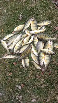
uploaded by: Craig Aulenback

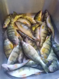
uploaded by: Craig Aulenback

uploaded by: Craig Aulenback

uploaded by: Craig Aulenback

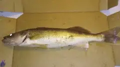
uploaded by: Eric Dixon_1

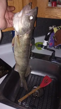
uploaded by: Stixy

uploaded by: Stixy

uploaded by: Stixy

uploaded by: Stixy

uploaded by: K Richard
Best Fishing Spots in the greater Bonner Springs area
We found a total of 21 potential fishing spots nearby Bonner Springs. Below you can find them organized on a map. Points, Headlands, Reefs, Islands, Channels, etc can all be productive fishing spots. As these are user submitted spots, there might be some errors in the exact location. You also need to cross check local fishing regulations. Some of the spots might be in or around marine reserves or other locations that cannot be fished. If you click on a location marker it will bring up some details and a quick link to google search, satellite maps and fishing times. Tip: Click/Tap on a new area to load more fishing spots.
Lake of the Forest Dam - 4km , Nelson Island - 7km , Shawnee Mission Park Pond - 11km , Johnson County Dam - 11km , Black Swan Dam - 13km , De Soto Railroad Bridge - 13km , Pierson Park Dam - 15km , Turner Memorial Bridge - 15km , Lenexa Rose's Pond - 15km , Marshall Creek Dam - 16km , Lenexa Resurrection Pond - 16km , Sunflower Park Lake - 17km , Kill Creek Pond South - 17km , Kill Creek Pond North - 17km , Johnson County Kill Creek Park North - 18km , Sunflower Pond B Dam - 18km , Nagwika Lake - 19km , Johnson County Kill Creek Park South - 19km , Mahaffie Farmstead Pond - 20km , Olathe Kansas City Road Park Pond - 20km , New Olathe Lake Dam - 20km
Comments