Boca Grande 🇺🇸
-
Nautical Twilight begins:05:59 amSunrise:06:51 am
-
Sunset:08:02 pmNautical Twilight ends:08:54 pm
-
Moonrise:08:05 am
-
Moonset:10:36 pm
-
Moon over:03:20 pm
-
Moon under:02:51 am
-
Visibility:5%
-
 Waxing Crescent
-
Distance to earth:366,045 kmProximity:93.1 %
Moon Phases for Boca Grande
-
excellent Day
-
major Time:01:51 am - 03:51 am
-
minor Time:07:05 am - 09:05 am
-
major Time:02:20 pm - 04:20 pm
-
minor Time:09:36 pm - 11:36 pm
Tide Clock
Tide Graph
Times
| Tide | Time | Height |
|---|---|---|
| high | 04:56 am | 1.21 ft |
| low | 08:41 am | 1.05 ft |
| high | 02:23 pm | 2.36 ft |
| low | 11:20 pm | -0.56 ft |
| Date | Major Bite Times | Minor Bite Times | Sun | Moon | Moonphase | Tide Times |
|---|---|---|---|---|---|---|
|
Tue, 29 Apr
|
01:51 am -
03:51 am
02:20 pm -
04:20 pm
|
07:05 am -
09:05 am
09:36 pm -
11:36 pm
|
R: 06:51 am S: 08:02 pm |
R: 08:05 am S: 10:36 pm |
Waxing Crescent |
high: 04:56 am
, 1.21 ft
, Coeff: 43
low: 08:41 am
, 1.05 ft
high: 02:23 pm
, 2.36 ft
, Coeff: 160
low: 11:20 pm
, -0.56 ft
|
|
Wed, 30 Apr
|
02:51 am -
04:51 am
03:23 pm -
05:23 pm
|
08:02 am -
10:02 am
10:45 pm -
12:45 am
|
R: 06:50 am S: 08:02 pm |
R: 09:02 am S: 11:45 pm |
Waxing Crescent |
high: 06:43 am
, 1.08 ft
, Coeff: 30
low: 08:22 am
, 1.08 ft
high: 03:01 pm
, 2.4 ft
, Coeff: 163
|
|
Thu, 01 May
|
03:52 am -
05:52 am
04:25 pm -
06:25 pm
|
09:05 am -
11:05 am
11:45 pm -
01:45 am
|
R: 06:49 am S: 08:03 pm |
R: 10:05 am S: - |
Waxing Crescent |
low: 12:20 am
, -0.49 ft
high: 03:45 pm
, 2.3 ft
, Coeff: 153
|
|
Fri, 02 May
|
04:58 am -
06:58 am
05:30 pm -
07:30 pm
|
10:11 am -
12:11 pm
11:45 pm -
01:45 am
|
R: 06:48 am S: 08:04 pm |
R: 11:11 am S: 12:45 am |
Waxing Crescent |
low: 01:26 am
, -0.36 ft
high: 04:36 pm
, 2.13 ft
, Coeff: 137
|
|
Sat, 03 May
|
05:56 am -
07:56 am
06:27 pm -
08:27 pm
|
12:37 am -
02:37 am
11:15 am -
01:15 pm
|
R: 06:48 am S: 08:04 pm |
R: 12:15 pm S: 01:37 am |
First Quarter Moon |
low: 02:35 am
, -0.23 ft
high: 05:40 pm
, 1.94 ft
, Coeff: 117
|
|
Sun, 04 May
|
06:48 am -
08:48 am
07:17 pm -
09:17 pm
|
01:19 am -
03:19 am
12:17 pm -
02:17 pm
|
R: 06:47 am S: 08:05 pm |
R: 01:17 pm S: 02:19 am |
First Quarter Moon |
low: 03:42 am
, -0.1 ft
high: 07:14 pm
, 1.67 ft
, Coeff: 90
|
|
Mon, 05 May
|
07:35 am -
09:35 am
08:03 pm -
10:03 pm
|
01:56 am -
03:56 am
01:14 pm -
03:14 pm
|
R: 06:46 am S: 08:05 pm |
R: 02:14 pm S: 02:56 am |
First Quarter Moon |
low: 04:38 am
, 0 ft
high: 11:50 am
, 1.31 ft
, Coeff: 53
low: 04:28 pm
, 1.15 ft
high: 09:12 pm
, 1.51 ft
, Coeff: 73
|
")


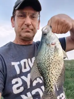
uploaded by: Mike Baron

uploaded by: Mike Baron

uploaded by: Mike Baron

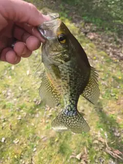
uploaded by: Bradley Wisdom

uploaded by: Bradley Wisdom

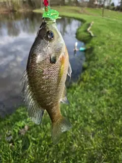
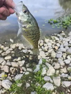
uploaded by: Joey Piercefield

uploaded by: Joey Piercefield

uploaded by: Joey Piercefield

uploaded by: Joey Piercefield

uploaded by: Joey Piercefield
Best Fishing Spots in the greater Boca Grande area
Beaches and Bays are ideal places for land-based fishing. If the beach is shallow and the water is clear then twilight times are usually the best times, especially when they coincide with a major or minor fishing time. Often the points on either side of a beach are the best spots. Or if the beach is large then look for irregularities in the breaking waves, indicating sandbanks and holes. We found 15 beaches and bays in this area.
Boca Grande Bayou - 1km , Bull Bay - 6km , Pelican Bay - 8km , Primo Bay - 9km , Old Tom Bayou - 9km , Turtle Bay - 10km , Tom Bay - 10km , Camp Key - 10km , Back Bay - 11km , Murdock Bayou - 11km , Little Bokeelia Bay - 11km , Water Turkey Bayou - 12km , Cape Haze Bay - 12km , Pebble Beach Creek - 16km , Smokehouse Bay - 17km
Harbours and Marinas can often times be productive fishing spots for land based fishing as their sheltered environment attracts a wide variety of bait fish. Similar to river mouths, harbour entrances are also great places to fish as lots of fish will move in and out with the rising and falling tides. There are 2 main harbours in this area.
Kettle Harbor - 12km, Yacht Basin - 16km
We found a total of 98 potential fishing spots nearby Boca Grande. Below you can find them organized on a map. Points, Headlands, Reefs, Islands, Channels, etc can all be productive fishing spots. As these are user submitted spots, there might be some errors in the exact location. You also need to cross check local fishing regulations. Some of the spots might be in or around marine reserves or other locations that cannot be fished. If you click on a location marker it will bring up some details and a quick link to google search, satellite maps and fishing times. Tip: Click/Tap on a new area to load more fishing spots.
Boca Grande Bayou - 1km , Three Sisters Island - 2km , Jack Point - 2km , Devilfish Key - 3km , Gasparilla Island - 3km , Hoagen Key - 3km , Sandfly Key - 5km , Cayo Pelau - 5km , Peekins Ranch Cove - 5km , Little Cape Haze - 5km , Bull Bay - 6km , Gasparilla Sound - 6km , Bull Key - 7km , Murdock Point - 7km , Gasparilla Pass - 7km , Bird Key - 8km , Punta Blanca Island - 8km , Catfish Point - 8km , Pelican Bay - 8km , Eagle Nest - 8km , Mound Key - 8km , Gallagher Keys - 8km , Punta Blanca - 9km , Boggess Hole - 9km , Primo Point - 9km , Primo Island - 9km , Primo Bay - 9km , Placida Harbor - 9km , Cayo Costa - 9km , Patricio Island - 9km , Old Tom Bayou - 9km , Mondongo Island - 9km , Mondongo Rocks - 9km , Little Gasparilla Island - 9km , Coral Cove - 10km , Turtle Bay - 10km , Tom Bay - 10km , Camp Key - 10km , Middle Key - 10km , Cape Haze - 10km , Little Bokeelia Island - 10km , Back Bay - 11km , Galleon Cove - 11km , Whoopee Island - 11km , Useppa Island - 11km , Bokeelia Island - 11km , Broken Islands - 11km , Rambler Hole - 11km , Cabbage Key - 11km , Platt Point - 11km , North Banks - 11km , Murdock Bayou - 11km , Little Gasparilla Pass (historical) - 11km , Little Bokeelia Bay - 11km , Captains Cut - 12km , Blue Heron Cove - 12km , Amberjack Cove - 12km , Water Turkey Bayou - 12km , Cape Haze Bay - 12km , Charlotte Harbor - 12km , Darling Key - 12km , Narrows Key - 12km , Narrows Cove - 12km , Kettle Harbor - 12km , Part Island - 13km , The Narrows - 13km , Big Jim Creek - 13km , Jug Creek - 13km , Coon Key - 13km , Sister Pond - 14km , Black Key - 14km , Bocilla Island - 14km , Cove Key - 14km , Bocilla Inlet - 14km , Don Pedro Island - 14km , Jug Creek Point - 15km , Wood Key - 15km , Pejuan Point - 15km , Pejuan Cove - 15km , Canal Number 1 - 15km , Canal Number 2 - 15km , Canal Number 3 - 15km , Lemon Lake - 15km , Palm Canal - 15km , Pine Valley Creek - 15km , Little Wood Key - 15km , Long Meadow Creek - 16km , Pebble Beach Creek - 16km , Yacht Basin - 16km , White Marsh Creek - 16km , Oakland Hills Creek - 16km , Rat Key - 16km , Halfway Point - 16km , Thorton Key - 17km , Pinehurst Creek - 17km , Knight Island - 17km , Smokehouse Bay - 17km , Lake View Canal - 17km
Comments