
Point Chevalier 🇳🇿
-
Nautical Twilight begins:05:58 amSunrise:06:53 am
-
Sunset:05:46 pmNautical Twilight ends:06:41 pm
-
Moonrise:02:11 am
-
Moonset:03:34 pm
-
Moon over:08:52 am
-
Moon under:09:28 pm
-
Visibility:20%
-
 Waning Crescent
-
Distance to earth:370,656 kmProximity:82.3 %
Moon Phases for Point Chevalier
-
good Day
-
minor Time:01:11 am - 03:11 am
-
major Time:07:52 am - 09:52 am
-
minor Time:02:34 pm - 04:34 pm
-
major Time:08:28 pm - 10:28 pm
Tide Clock
Tide Graph
Times
| Tide | Time | Height |
|---|---|---|
| high | 03:44 am | 10.1 ft |
| low | 09:45 am | 2.89 ft |
| high | 04:08 pm | 9.81 ft |
| low | 10:09 pm | 2.85 ft |
| Date | Major Bite Times | Minor Bite Times | Sun | Moon | Moonphase | Tide Times |
|---|---|---|---|---|---|---|
|
Thu, 24 Apr
|
07:52 am -
09:52 am
08:28 pm -
10:28 pm
|
01:11 am -
03:11 am
02:34 pm -
04:34 pm
|
R: 06:53 am S: 05:46 pm |
R: 02:11 am S: 03:34 pm |
Waning Crescent |
high: 03:44 am
, 10.1 ft
, Coeff: 74
low: 09:45 am
, 2.89 ft
high: 04:08 pm
, 9.81 ft
, Coeff: 70
low: 10:09 pm
, 2.85 ft
|
|
Fri, 25 Apr
|
08:41 am -
10:41 am
09:17 pm -
11:17 pm
|
02:22 am -
04:22 am
03:01 pm -
05:01 pm
|
R: 06:54 am S: 05:44 pm |
R: 03:22 am S: 04:01 pm |
Waning Crescent |
high: 04:44 am
, 10.6 ft
, Coeff: 82
low: 10:41 am
, 2.33 ft
high: 05:14 pm
, 10.37 ft
, Coeff: 78
low: 11:08 pm
, 2.33 ft
|
|
Sat, 26 Apr
|
09:31 am -
11:31 am
10:09 pm -
12:09 am
|
03:34 am -
05:34 am
03:29 pm -
05:29 pm
|
R: 06:55 am S: 05:43 pm |
R: 04:34 am S: 04:29 pm |
Waning Crescent |
high: 05:41 am
, 11.12 ft
, Coeff: 90
low: 11:36 am
, 1.71 ft
high: 06:14 pm
, 11.02 ft
, Coeff: 88
|
|
Sun, 27 Apr
|
10:24 am -
12:24 pm
11:03 pm -
01:03 am
|
04:50 am -
06:50 am
03:59 pm -
05:59 pm
|
R: 06:56 am S: 05:42 pm |
R: 05:50 am S: 04:59 pm |
New Moon |
low: 12:03 am
, 1.77 ft
high: 06:35 am
, 11.58 ft
, Coeff: 96
low: 12:28 pm
, 1.12 ft
high: 07:08 pm
, 11.61 ft
, Coeff: 97
|
|
Mon, 28 Apr
|
11:21 am -
01:21 pm
10:41 pm -
12:41 am
|
06:08 am -
08:08 am
04:35 pm -
06:35 pm
|
R: 06:57 am S: 05:41 pm |
R: 07:08 am S: 05:35 pm |
New Moon |
low: 12:56 am
, 1.31 ft
high: 07:27 am
, 11.88 ft
, Coeff: 101
low: 01:19 pm
, 0.72 ft
high: 08:00 pm
, 12.04 ft
, Coeff: 104
|
|
Tue, 29 Apr
|
12:21 pm -
02:21 pm
11:41 pm -
01:41 am
|
07:27 am -
09:27 am
05:16 pm -
07:16 pm
|
R: 06:57 am S: 05:40 pm |
R: 08:27 am S: 06:16 pm |
New Moon |
low: 01:47 am
, 1.05 ft
high: 08:20 am
, 11.94 ft
, Coeff: 102
low: 02:10 pm
, 0.52 ft
high: 08:51 pm
, 12.24 ft
, Coeff: 106
|
|
Wed, 30 Apr
|
12:50 am -
02:50 am
01:26 pm -
03:26 pm
|
08:46 am -
10:46 am
06:07 pm -
08:07 pm
|
R: 06:58 am S: 05:39 pm |
R: 09:46 am S: 07:07 pm |
Waxing Crescent |
low: 02:38 am
, 1.05 ft
high: 09:12 am
, 11.81 ft
, Coeff: 100
low: 03:01 pm
, 0.56 ft
high: 09:42 pm
, 12.17 ft
, Coeff: 106
|


uploaded by: Craig Aulenback

uploaded by: Craig Aulenback

uploaded by: Craig Aulenback

uploaded by: Craig Aulenback

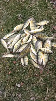
uploaded by: Eric Dixon_1

uploaded by: Stixy

uploaded by: Stixy

uploaded by: Stixy

uploaded by: Stixy

uploaded by: K Richard
Best Fishing Spots in the greater Point Chevalier area
Wharf's or Jetties are good places to wet a line and meet other fishermen. They often produce a fresh feed of fish and are also great to catch bait fish. As they are often well lit, they also provide a good opportunity for night fishing. There are 6 wharf(s) in this area.
Ponsonby Wharf - 3km , Bayswater Wharf - 7km , Victoria Wharf - 9km , Orakei Wharf - 10km , Torpedo Wharf - 10km , Onehunga Wharf - 10km
Beaches and Bays are ideal places for land-based fishing. If the beach is shallow and the water is clear then twilight times are usually the best times, especially when they coincide with a major or minor fishing time. Often the points on either side of a beach are the best spots. Or if the beach is large then look for irregularities in the breaking waves, indicating sandbanks and holes. We found 48 beaches and bays in this area.
Coxs Bay - 2km , Point Chevalier Beach - 2km , Home Bay - 3km , Herne Bay - 3km , Chelsea Bay - 5km , Onetaunga Bay - 5km , Saint Marys Bay - 5km , Green Bay - 6km , Halls Beach - 6km , Little Shoal Bay - 6km , Freemans Bay - 6km , Wattle Bay - 7km , Blockhouse Bay - 7km , Fitzpatrick Bay - 7km , Soldiers Bay - 7km , Island Bay - 7km , Mechanics Bay - 7km , Bayswater Wharf - 7km , Sulphur Beach - 7km , City of Cork Beach - 7km , Faulkner Bay - 8km , Waikowhai Bay - 8km , Wesley Bay - 8km , Charcoal Bay - 8km , Brickbat Bay - 8km , Waipareira Bay - 8km , Grannys Bay - 8km , Judges Bay - 8km , Stanley Bay - 8km , Hillsborough Bay - 9km , Duders Beach - 9km , Hobson Bay - 9km , Devonport Beach - 9km , Ngataringa Bay - 9km , Bomb Bay - 9km , Catalina Bay - 9km , Oatoru Bay - 9km , Wood Bay - 9km , Limeburners Bay - 9km , Shoal Bay - 9km , Okahu Bay - 10km , Cheltenham Beach - 10km , Torpedo Bay - 10km , Narrow Neck Beach - 10km , Saint Leonards Beach - 10km , Sunset Bay - 10km , Takapuna Beach - 10km , French Bay (Otitori Bay) - 10km
Harbours and Marinas can often times be productive fishing spots for land based fishing as their sheltered environment attracts a wide variety of bait fish. Similar to river mouths, harbour entrances are also great places to fish as lots of fish will move in and out with the rising and falling tides. There are 9 main harbours in this area.
Waitemata Harbour - 5km, Auckland Harbour Bridge - 5km, Westhaven Boat Harbor - 5km, Auckland Port - 6km, Mechanics Bay - 7km, Commercial Harbour - 7km, Devonport Beach - 9km, West Harbour - 10km, Upper Harbour Bridge - 10km
We found a total of 96 potential fishing spots nearby Point Chevalier. Below you can find them organized on a map. Points, Headlands, Reefs, Islands, Channels, etc can all be productive fishing spots. As these are user submitted spots, there might be some errors in the exact location. You also need to cross check local fishing regulations. Some of the spots might be in or around marine reserves or other locations that cannot be fished. If you click on a location marker it will bring up some details and a quick link to google search, satellite maps and fishing times. Tip: Click/Tap on a new area to load more fishing spots.
Coxs Bay - 2km , Western Springs - 2km , Point Chevalier Beach - 2km , Traherne Island - 2km , Ponsonby Wharf - 3km , Point Chevalier - 3km , Home Bay - 3km , Herne Bay - 3km , Watchman Island - 4km , Pollen Island - 4km , Chelsea Bay - 5km , Kauri Point - 5km , Kauri Point Birkenhead - 5km , Waitemata Harbour - 5km , Onetaunga Bay - 5km , Westhaven - 5km , Auckland Harbour Bridge - 5km , Stoke Point - 5km , Saint Marys Bay - 5km , Westhaven Boat Harbor - 5km , Point Erin - 5km , Green Bay - 6km , Halls Beach - 6km , Little Shoal Bay - 6km , Auckland Port - 6km , Freemans Bay - 6km , Wattle Bay - 7km , Lynfield Cove - 7km , Te Whau Point - 7km , Blockhouse Bay - 7km , Fitzpatrick Bay - 7km , Soldiers Bay - 7km , Island Bay - 7km , Mechanics Bay - 7km , Commercial Harbour - 7km , Stanley Point - 7km , Bayswater Wharf - 7km , O'Neill's Point - 7km , Sulphur Beach - 7km , City of Cork Beach - 7km , Luckens Point - 8km , Cape Horn - 8km , Faulkner Bay - 8km , Waikowhai Bay - 8km , Wesley Bay - 8km , Charcoal Bay - 8km , Scott Point - 8km , Bofors Point - 8km , Orion Point - 8km , Brickbat Bay - 8km , Nimrod Inlet - 8km , Waipareira Bay - 8km , Orukuwai Point - 8km , Grannys Bay - 8km , Point Resolution - 8km , Judges Bay - 8km , Stanley Bay - 8km , Hillsborough Bay - 9km , Orakei Basin - 9km , Pakanoa Point - 9km , Hobson Point - 9km , Duders Beach - 9km , Motukaraka Bank - 9km , Hobson Bay - 9km , Victoria Wharf - 9km , Devonport Beach - 9km , Ngataringa Bay - 9km , Duders Point - 9km , Harrier Point - 9km , Bomb Bay - 9km , Catalina Bay - 9km , Opou Point - 9km , Oatoru Bay - 9km , Wood Bay - 9km , Limeburners Bay - 9km , Shoal Bay - 9km , Takaparawha Point - 10km , North Head - 10km , Okahu Bay - 10km , Orakei Wharf - 10km , Torpedo Wharf - 10km , Cheltenham Beach - 10km , Torpedo Bay - 10km , West Harbour - 10km , Narrow Neck Beach - 10km , Takapuna Head - 10km , Waiarohia Inlet - 10km , Saint Leonards Beach - 10km , Weeks Island - 10km , Sunset Bay - 10km , Herald Island - 10km , Takapuna Beach - 10km , Onehunga Wharf - 10km , Upper Harbour Bridge - 10km , French Bay (Otitori Bay) - 10km , Shag Point - 10km
Comments