

Paynesville 🇦🇺
-
Nautical Twilight begins:05:49 amSunrise:06:45 am
-
Sunset:05:28 pmNautical Twilight ends:06:25 pm
-
Moonrise:05:45 am
-
Moonset:04:48 pm
-
Moon over:11:16 am
-
Moon under:11:56 pm
-
Visibility:1%
-
 New Moon
-
Distance to earth:363,434 kmProximity:99.2 %
Moon Phases for Paynesville
-
excellent Day
-
minor Time:04:45 am - 06:45 am
-
major Time:10:16 am - 12:16 pm
-
minor Time:
 03:48 pm -
05:48 pm
03:48 pm -
05:48 pm
-
major Time:10:56 pm - 12:56 am
Tide Clock
Tide Graph
Times
| Tide | Time | Height |
|---|---|---|
| low | 02:02 am | 0.75 ft |
| high | 08:13 am | 3.22 ft |
| low | 02:05 pm | 0.98 ft |
| high | 08:25 pm | 3.71 ft |
| Date | Major Bite Times | Minor Bite Times | Sun | Moon | Moonphase | Tide Times |
|---|---|---|---|---|---|---|
|
Sun, 27 Apr
|
10:16 am -
12:16 pm
10:56 pm -
12:56 am
|
04:45 am -
06:45 am
03:48 pm -
05:48 pm
|
R: 06:45 am S: 05:28 pm |
R: 05:45 am S: 04:48 pm |
New Moon |
low: 02:02 am
, 0.75 ft
high: 08:13 am
, 3.22 ft
, Coeff: 71
low: 02:05 pm
, 0.98 ft
high: 08:25 pm
, 3.71 ft
, Coeff: 94
|
|
Mon, 28 Apr
|
11:13 am -
01:13 pm
10:32 pm -
12:32 am
|
06:04 am -
08:04 am
04:23 pm -
06:23 pm
|
R: 06:46 am S: 05:27 pm |
R: 07:04 am S: 05:23 pm |
New Moon |
low: 02:56 am
, 0.62 ft
high: 09:12 am
, 3.12 ft
, Coeff: 66
low: 02:45 pm
, 1.18 ft
high: 09:09 pm
, 3.9 ft
, Coeff: 103
|
|
Tue, 29 Apr
|
12:14 pm -
02:14 pm
11:34 pm -
01:34 am
|
07:25 am -
09:25 am
05:04 pm -
07:04 pm
|
R: 06:47 am S: 05:26 pm |
R: 08:25 am S: 06:04 pm |
New Moon |
low: 03:51 am
, 0.56 ft
high: 10:10 am
, 2.99 ft
, Coeff: 60
low: 03:26 pm
, 1.41 ft
high: 09:56 pm
, 4 ft
, Coeff: 108
|
|
Wed, 30 Apr
|
12:43 am -
02:43 am
01:19 pm -
03:19 pm
|
08:44 am -
10:44 am
05:55 pm -
07:55 pm
|
R: 06:48 am S: 05:25 pm |
R: 09:44 am S: 06:55 pm |
Waxing Crescent |
low: 04:49 am
, 0.62 ft
high: 11:10 am
, 2.82 ft
, Coeff: 52
low: 04:09 pm
, 1.67 ft
high: 10:45 pm
, 4 ft
, Coeff: 108
|
|
Thu, 01 May
|
01:56 am -
03:56 am
02:26 pm -
04:26 pm
|
09:56 am -
11:56 am
06:56 pm -
08:56 pm
|
R: 06:49 am S: 05:24 pm |
R: 10:56 am S: 07:56 pm |
Waxing Crescent |
low: 05:49 am
, 0.72 ft
high: 12:13 pm
, 2.69 ft
, Coeff: 46
low: 04:56 pm
, 1.94 ft
high: 11:37 pm
, 3.94 ft
, Coeff: 105
|
|
Fri, 02 May
|
03:06 am -
05:06 am
03:30 pm -
05:30 pm
|
10:56 am -
12:56 pm
08:04 pm -
10:04 pm
|
R: 06:50 am S: 05:22 pm |
R: 11:56 am S: 09:04 pm |
Waxing Crescent |
low: 06:55 am
, 0.89 ft
high: 01:24 pm
, 2.59 ft
, Coeff: 42
low: 05:51 pm
, 2.17 ft
|
|
Sat, 03 May
|
04:10 am -
06:10 am
04:29 pm -
06:29 pm
|
11:44 am -
01:44 pm
09:14 pm -
11:14 pm
|
R: 06:51 am S: 05:21 pm |
R: 12:44 pm S: 10:14 pm |
First Quarter Moon |
high: 12:32 am
, 3.81 ft
, Coeff: 98
low: 08:08 am
, 0.98 ft
high: 03:00 pm
, 2.56 ft
, Coeff: 40
low: 06:58 pm
, 2.33 ft
|
")


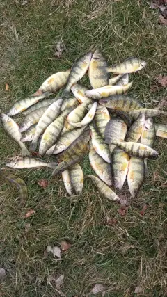
uploaded by: Mr catch it
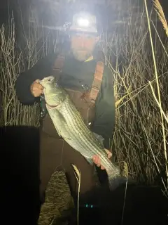
uploaded by: Graeme Lhuillier

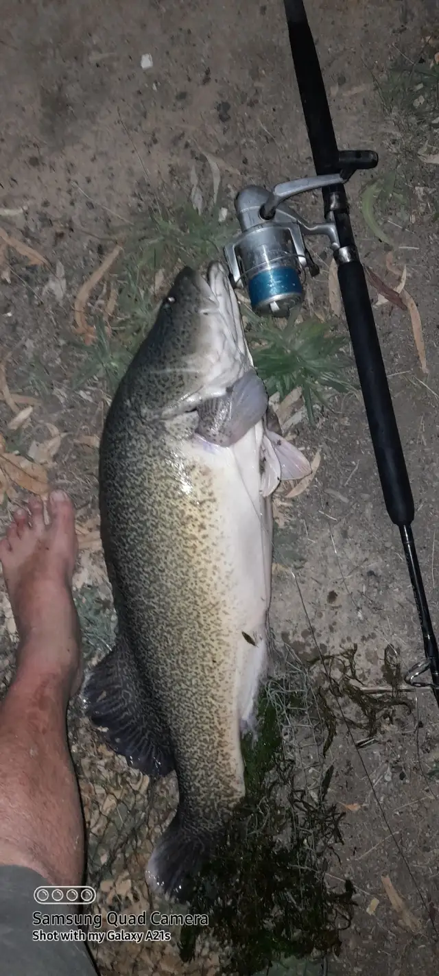
uploaded by: Tony Barker_1

uploaded by: Zander Paul Slabber

uploaded by: Craig Aulenback

uploaded by: Craig Aulenback

uploaded by: Craig Aulenback

uploaded by: Craig Aulenback

uploaded by: Eric Dixon_1

uploaded by: Stixy
Paynesville
Best Fishing Spots in the greater Paynesville area
Wharf's or Jetties are good places to wet a line and meet other fishermen. They often produce a fresh feed of fish and are also great to catch bait fish. As they are often well lit, they also provide a good opportunity for night fishing. There are 1 wharf(s) in this area.
Nungurner Jetty - 16km
Beaches and Bays are ideal places for land-based fishing. If the beach is shallow and the water is clear then twilight times are usually the best times, especially when they coincide with a major or minor fishing time. Often the points on either side of a beach are the best spots. Or if the beach is large then look for irregularities in the breaking waves, indicating sandbanks and holes. We found 16 beaches and bays in this area.
Lady Bay - 3km , Picnic Bay - 4km , Eagle Point Bay - 4km , Tatungalung Bay - 5km , Duck Bay - 5km , Jones Bay - 6km , Mason Bay - 6km , Wollaston Bay - 7km , Mullet Bay - 8km , Cherry Tree Beach - 9km , Swan Reach Bay - 10km , Tambo Bay - 11km , Steel Bay - 13km , Bancroft Bay - 14km , Yellow Bay - 15km , Pelican Bay - 16km
We found a total of 40 potential fishing spots nearby Paynesville. Below you can find them organized on a map. Points, Headlands, Reefs, Islands, Channels, etc can all be productive fishing spots. As these are user submitted spots, there might be some errors in the exact location. You also need to cross check local fishing regulations. Some of the spots might be in or around marine reserves or other locations that cannot be fished. If you click on a location marker it will bring up some details and a quick link to google search, satellite maps and fishing times. Tip: Click/Tap on a new area to load more fishing spots.
Burrabogie Island - 1km , Fort King - 2km , Newlands Backwater - 2km , Raymond Island - 3km , Lady Bay - 3km , Picnic Bay - 4km , Eagle Point Bay - 4km , Rotten Island - 5km , Tatungalung Bay - 5km , Radford Bank - 5km , Lake Killarney - 5km , Duck Bay - 5km , Crescent Island - 6km , Waddy Island - 6km , Barton Island - 6km , Rotamah Island - 6km , Jones Bay - 6km , Mason Bay - 6km , Lake King - 6km , Wallaby Island - 6km , Wollaston Bay - 7km , Mullet Bay - 8km , Cherry Tree Beach - 9km , Jones Island - 9km , Lake Victoria - 10km , Swan Reach Bay - 10km , Gippsland Lakes - 11km , Sperm Whale Head - 11km , Tambo Bay - 11km , Salt Lake - 12km , Steel Bay - 13km , Bancroft Bay - 14km , Linds Bridge - 15km , Pelican Island - 15km , Yellow Bay - 15km , Pelican Bay - 16km , Nungurner Jetty - 16km , Flannagans Island - 17km , Fred Albert Bridge - 19km , Storm Point - 20km
Comments